


Tucked away in northern Arizona near Marble Canyon, Vermilion Cliffs National Monument is one of the most jaw-dropping places in the entire American Southwest. Towering walls of red, orange, and pink sandstone rise thousands of feet into the sky, creating a landscape so otherworldly that visitors often struggle to believe it is real.
Spanning roughly 280,000 acres, this remote and largely unspoiled monument holds some of the most spectacular geology, wildlife, and hiking trails on the planet. Whether you are a road tripper, a nature lover, or just someone looking for a truly unforgettable experience, Vermilion Cliffs will absolutely blow your mind.
The Towering Sandstone Cliffs Along Highway 89A
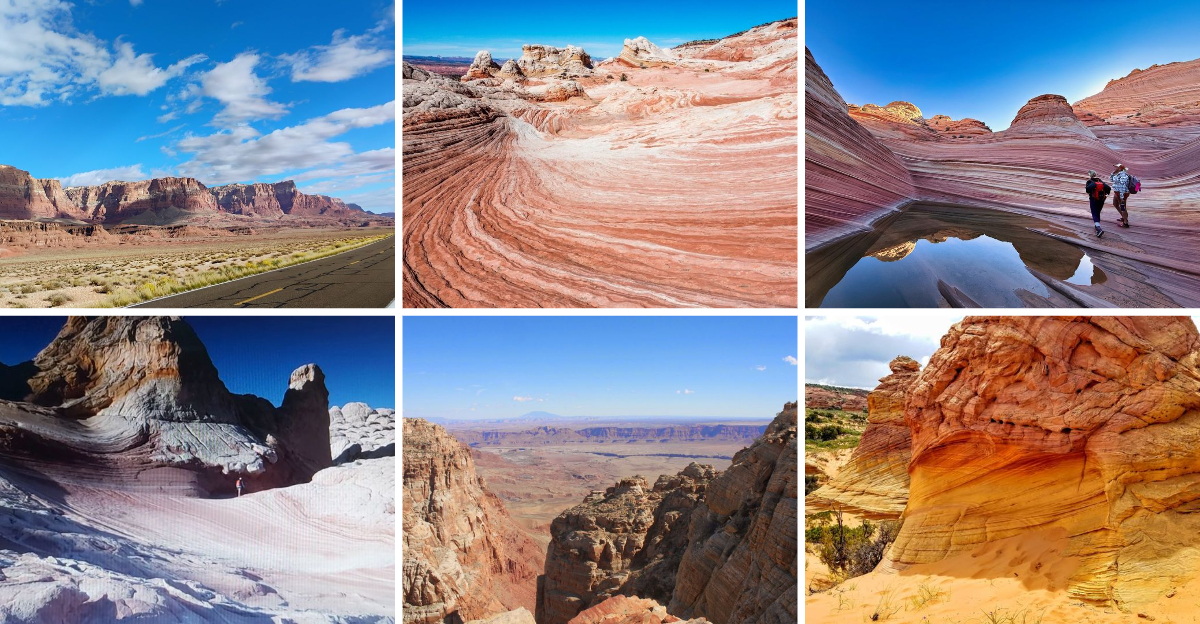
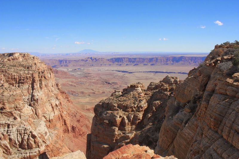
Few drives in America hit you the way Highway 89A does when those massive cliffs suddenly appear on the horizon. The Vermilion Cliffs rise up to 3,000 feet above their base, and the layers of red, orange, and cream-colored rock are stacked like pages in an ancient book.
Each stripe tells a story millions of years in the making.
As you cruise along the highway, pull-off spots invite you to step out and truly take it all in. Photos help, but honestly, standing beneath those walls puts your own size into perspective in a humbling, almost magical way.
Visiting at sunrise or sunset cranks the color up to an almost unreal level. The cliffs glow like embers, and the sky above shifts through shades of purple and gold.
Locals and first-timers alike agree: this stretch of road is one of the most breathtaking scenic drives in the country.
White Pocket: A Swirling Rock Wonderland
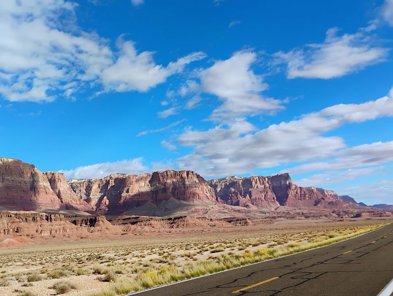
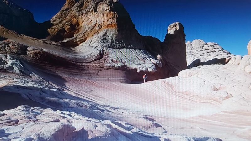
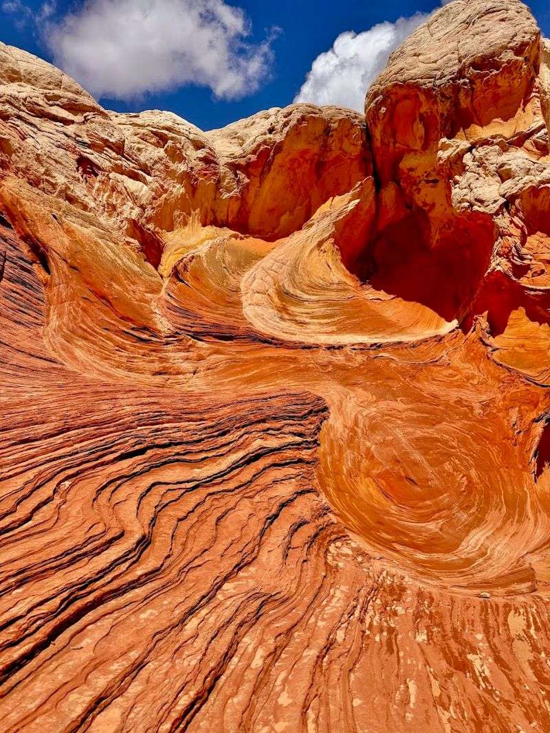
White Pocket looks like someone poured cake batter over the desert floor and let it harden into something extraordinary. The rock surface swirls in patterns that resemble brain coral, melted wax, and crumpled fabric all at once.
Geologists call it “contorted crossbedding,” but most visitors just call it unbelievable.
Getting there requires a high-clearance 4×4 vehicle and a willingness to navigate sandy backcountry roads, but the payoff is absolutely worth every bumpy mile. Unlike some famous landmarks, White Pocket rarely feels crowded, so you can wander the formations and snap photos at your own pace.
Colors here shift dramatically depending on the light. Morning light brings out soft pinks and creams, while afternoon sun deepens the reds and oranges to a rich, almost glowing warmth.
Bring plenty of water, a full tank of gas, and prepare to feel like you landed on Mars.
The Wave: Nature’s Most Famous Swirling Sculpture
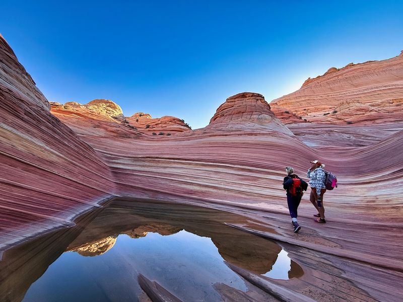
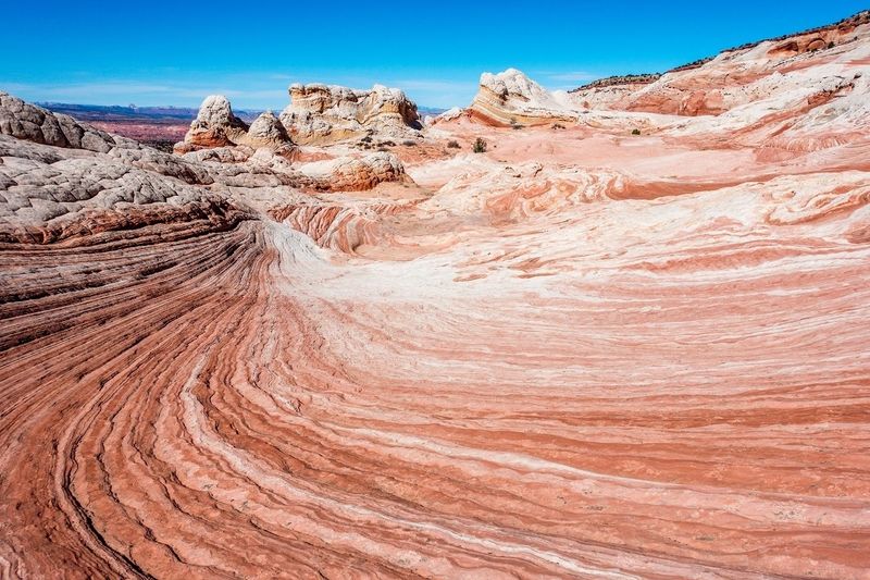
Somewhere between a painting and a dream, The Wave is one of the most photographed geological features on Earth. Located in the Coyote Buttes North section of the monument, this formation features smooth, flowing curves of layered sandstone that ripple like frozen ocean waves.
The colors range from deep burgundy to soft apricot, all blending seamlessly together.
Access is strictly controlled through a permit lottery system managed by the Bureau of Land Management. Only 64 people are allowed in per day, split between an online advance lottery and a daily in-person draw.
Competition is fierce, so applying early and often is your best strategy.
Even if the lottery does not go your way, the surrounding Coyote Buttes area offers stunning scenery that rivals almost anything else in Arizona. Many visitors say the anticipation of finally getting a permit makes the experience even more emotionally rewarding when the day finally arrives.
Buckskin Gulch: The World’s Longest Slot Canyon
Stretching over 13 miles, Buckskin Gulch holds the record as the longest and deepest slot canyon in the American Southwest. The walls press in close on both sides, sometimes narrowing to just a few feet wide, while soaring 500 feet above your head.
Sunlight filters down in thin shafts, painting the canyon floor in shifting shades of gold and shadow.
Hiking through Buckskin Gulch feels more like exploring a secret underground world than walking through a desert. Flash flood risk is real here, so always check the weather forecast before heading in and never enter if rain is expected anywhere in the drainage area upstream.
The hike connects to Paria Canyon, making it possible to plan a multi-day backpacking adventure through some of the most remote and visually stunning terrain in Arizona. Reviewers who have completed it consistently call it one of the top hiking experiences of their lives.
California Condors Soaring Overhead
One of the most thrilling surprises at Vermilion Cliffs has nothing to do with rock formations. Look up, and you might spot a California condor riding thermal currents with a wingspan stretching nearly ten feet across.
These birds were once on the brink of extinction, with only 27 individuals remaining in the wild in the 1980s.
Vermilion Cliffs became a key release site for captive-bred condors starting in 1996, and the program has been a remarkable conservation success story. Today, the population in the area continues to grow, and sightings along the cliffs and near Navajo Bridge are relatively common for patient observers.
Binoculars are highly recommended if you want a close-up view without disturbing these magnificent birds. Watching a condor glide effortlessly against the backdrop of those blazing red cliffs is one of those rare wildlife moments that stays with you for the rest of your life.
Wire Pass Trail and Its Hidden Teepee Formations
Wire Pass Trail is the kind of hike that starts simple and quickly becomes spectacular. The trailhead sits just off House Rock Valley Road, and within minutes you are squeezing through tight sandstone walls that block out most of the sky.
The canyon feels ancient, quiet, and completely separate from the outside world.
What makes Wire Pass extra special is what happens when you wander slightly off the main path. Hidden among the surrounding terrain are clusters of naturally eroded formations that look remarkably like teepees or small stone towers.
Many hikers walk right past them without realizing they are there.
The trail also connects to Buckskin Gulch, giving adventurous hikers the option to extend their journey significantly. Even on a shorter out-and-back visit, Wire Pass delivers more visual drama per mile than almost any other trail in the monument.
One reviewer called it better than Antelope Canyon, and it is hard to argue.
Marble Canyon and the Historic Navajo Bridge
Where the Colorado River carves through Marble Canyon, history and geology collide in the most dramatic way imaginable. The original Navajo Bridge, built in 1929, was once the only crossing of the Colorado River for hundreds of miles in any direction.
Today it stands preserved beside a newer vehicle bridge, and pedestrians can walk across it for free.
Standing on the bridge and peering 467 feet straight down into the turquoise-green river below is simultaneously terrifying and thrilling. California condors often perch on the bridge railings, completely unbothered by passing visitors, making it one of the easiest places in the monument to observe these rare birds up close.
The nearby Marble Canyon Lodge and Lees Ferry Lodge give travelers a base camp with serious old-West character. Multiple reviewers specifically mentioned their overnight stay in Marble Canyon as the highlight of entire multi-park road trips through Arizona and Utah.
Lees Ferry: A Gateway to Grand Canyon Rafting
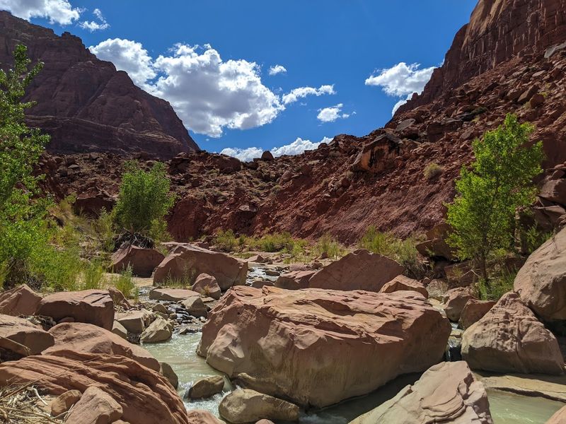
Lees Ferry holds a legendary status among river runners because it marks the official starting point for Grand Canyon rafting trips. Every year, thousands of adventurers launch their boats into the Colorado River right here, beginning one of the most celebrated river journeys on the planet.
The history of this spot runs deep, stretching back to John D. Lee, who operated a ferry crossing here in the 1870s.
Even if you have zero plans to raft, Lees Ferry is worth a visit on its own. The Cathedral Wash hike nearby offers a challenging scramble through a boulder-filled canyon that rewards determined hikers with sweeping views of the river and surrounding cliffs.
One reviewer warned that you do almost as much climbing as walking, which sounds about right.
Fishing is also hugely popular here, as Lees Ferry is one of the best trout fishing spots in Arizona. The cold, clear water released from Glen Canyon Dam creates ideal conditions year-round.
Dispersed Camping Under Impossibly Bright Stars
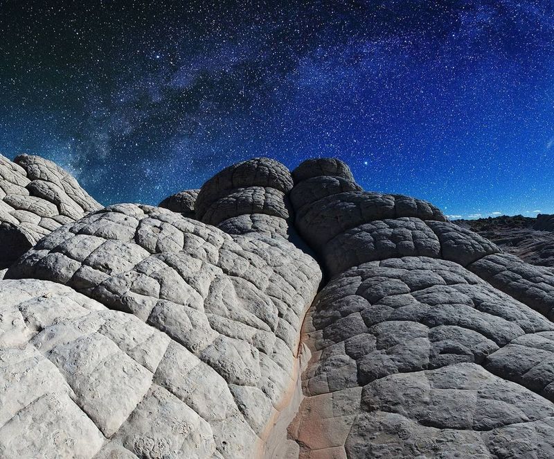
Sleeping under the stars at Vermilion Cliffs is an experience that resets your entire understanding of the night sky. Far from city lights and major highways, the darkness here is profound, and on a clear night the Milky Way stretches overhead like a river of light.
It is the kind of sky that makes you feel both incredibly small and deeply connected to something enormous.
Dispersed camping is permitted throughout much of the monument, meaning you can set up camp in remote areas without needing a designated campsite reservation. No hookups, no camp store, no neighbors crowding your space.
Just open desert, dramatic rock formations, and absolute silence.
Come fully prepared with everything you need, including extra water, food, and a reliable map. Cell service is essentially nonexistent in most areas.
Reviewers consistently praise the solitude and the sense of freedom that comes with spending a night this far off the beaten path.
The Paria Canyon Wilderness Backpacking Route
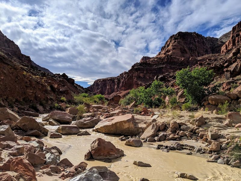
Paria Canyon is the kind of place that serious backpackers talk about in reverent, almost hushed tones. The multi-day route runs roughly 38 miles from the White House Trailhead in Utah down to Lees Ferry in Arizona, following the Paria River through one of the most scenic canyon corridors in the entire Southwest.
You will wade through shallow water, squeeze through narrow canyon passages, and camp on sandy benches surrounded by walls that glow red and orange in the evening light. Permits are required and are issued through a lottery system similar to The Wave, so planning ahead is essential.
Spring and fall offer the best conditions, as summer flash flood risk is significant and winter temperatures can be brutally cold at night. Those who complete the full route almost universally describe it as a life-changing experience.
The canyon rewards effort generously, offering solitude and scenery that simply cannot be replicated anywhere else.
Coyote Buttes South: Teepees of Stone
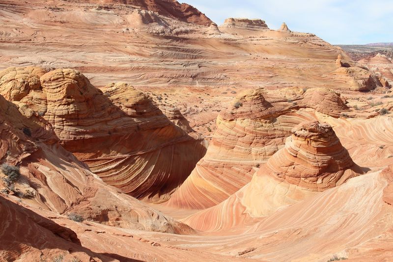
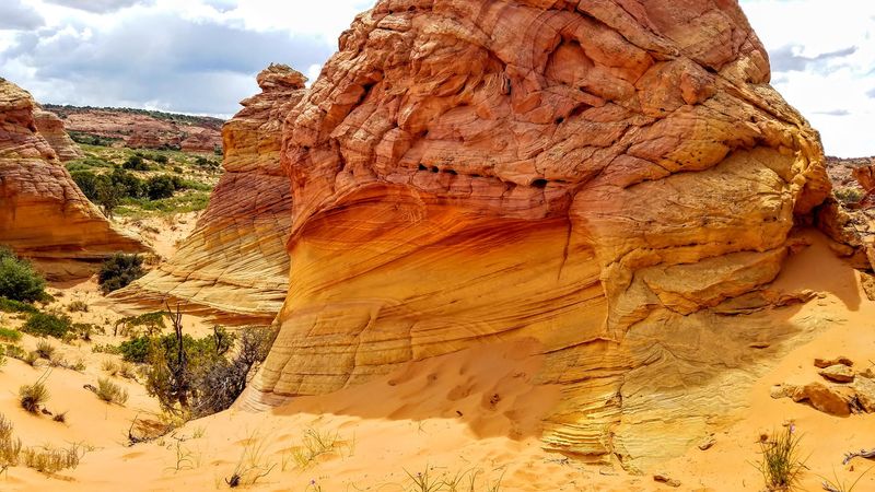
While The Wave gets most of the fame, Coyote Buttes South is quietly stealing hearts one visit at a time. This section of the monument features a surreal collection of banded sandstone formations nicknamed “The Teepees” because of their tall, pointed shapes.
The stripes of color running through each formation look almost hand-painted.
Access also requires a permit, though the lottery for Coyote Buttes South is slightly less competitive than its northern counterpart. Winners of the Canyon Buttes South lottery have described the experience as absolutely worth the effort, with one reviewer calling their guide from Dreamland Safari Tours the cherry on top of an already perfect day.
The terrain here is fragile and delicate, so staying on established paths and following Leave No Trace principles is critically important. Every footstep in the wrong place can damage formations that took millions of years to develop.
Treat this landscape with the respect it deserves.
Motorcycle Riding Through One of America’s Best Scenic Routes
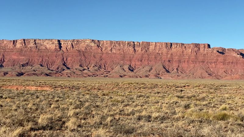
Ask any motorcyclist who has ridden the stretch of Highway 89A from Kanab through Marble Canyon, and their eyes will light up immediately. The road curves through open desert, past towering red cliffs, alongside the Colorado River, and eventually connects to Horseshoe Bend and the town of Page.
One reviewer called it the best motorcycle ride of their life, and the enthusiasm is completely understandable.
The combination of wide-open throttle straightaways, sweeping curves, and non-stop scenery makes this route a bucket-list ride for two-wheeled travelers from around the world. Traffic is light compared to most scenic routes, which means you can actually absorb the landscape rather than staring at bumpers.
Plan a fuel stop in Marble Canyon or Page, as gas stations are sparse along this stretch. Riding at sunrise adds an extra layer of magic, with the cliffs catching that first golden light and the road practically glowing in front of you.
A Landscape That Humbles Even the Most Seasoned Traveler
Some places simply stop you in your tracks, and Vermilion Cliffs is absolutely one of them. A reviewer who visited put it perfectly: words and photos cannot do justice to this foreign, astounding landscape.
Standing among those ancient rock formations, it becomes genuinely easy to forget you are on the same planet as the rest of humanity.
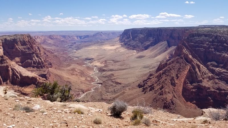
The monument spans elevations from 3,100 to 7,100 feet, meaning the scenery shifts dramatically as you move through different sections. Mesas, buttes, slot canyons, and open plateaus all exist within the same protected area, offering endless variety for curious explorers.
Whether you visit for a quick roadside stop or spend several days hiking deep into the backcountry, Vermilion Cliffs leaves a mark on you. Reviewers from all walks of life, first-time visitors and seasoned adventurers alike, consistently rank it among the most extraordinary places they have ever experienced anywhere on Earth.
Enjoyed this story?
Add Fast Food Club as a preferred source to see more of our reporting on Google.