


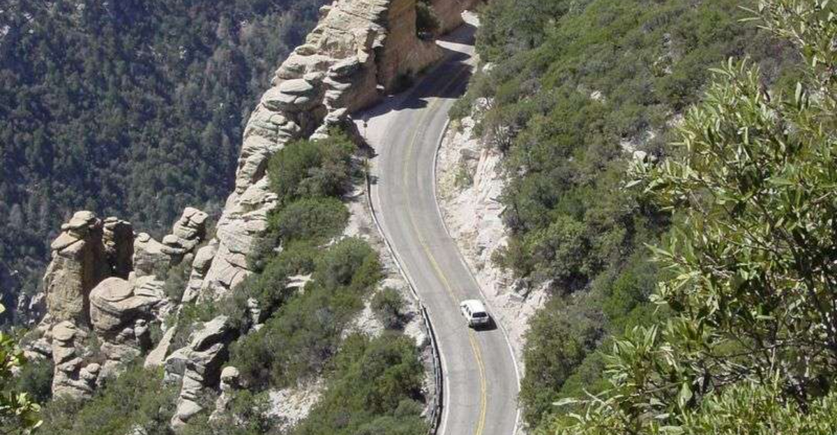
Tucked away on the edge of Tucson, Catalina Highway climbs nearly 6,000 feet in just 24 miles, taking you through five distinct life zones in a single afternoon. Most visitors to Arizona rush straight to the Grand Canyon or Sedona, completely overlooking this hidden gem winding up Mount Lemmon in the Santa Catalina Mountains.
The drive shifts from hot Sonoran Desert to cool pine forests, offering jaw-dropping views and wildlife sightings that feel almost unreal. If you love road trips with big rewards and zero crowds, this is one Arizona adventure worth putting at the top of your list.
The Starting Point: Tucson’s Gateway to the Sky
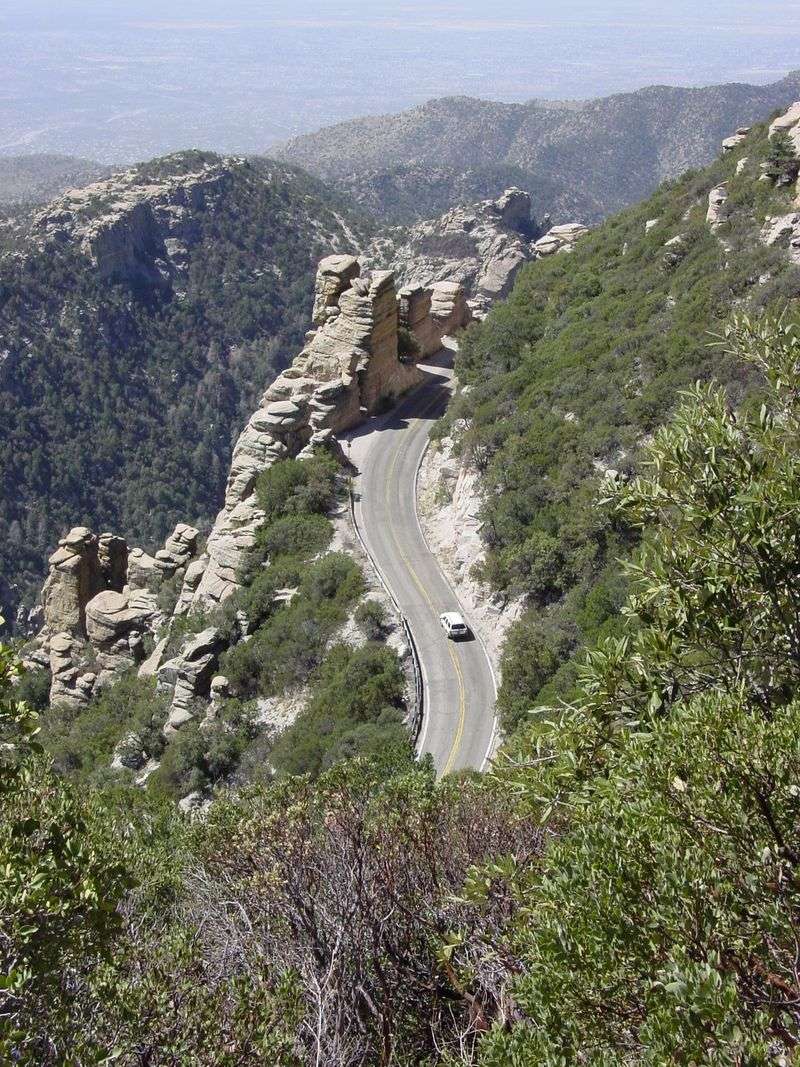
Right at the edge of Tucson, the drive begins almost without warning. One moment you are surrounded by suburban streets and strip malls, and the next, the road tilts upward and the Sonoran Desert stretches out behind you like a painting.
The starting elevation sits around 2,800 feet, and the air already carries a hint of warmth and dust that feels uniquely southwestern. Picking up snacks or filling your gas tank before heading out is a smart move, since services disappear quickly once you start climbing.
Many locals treat this road as a daily commute, but for visitors, it feels like stepping into a completely different world. Starting early in the morning gives you cooler temperatures and the best lighting for photos.
The beginning of the route sets the tone for everything ahead, so slow down and soak it all in from the very first mile.
Saguaro Cacti Lining the Lower Slopes
Few sights in the American Southwest are as iconic as a towering saguaro cactus, and the lower miles of Catalina Highway deliver them in spectacular fashion. These giants can live over 150 years and grow arms only after reaching about 75 years old, making every one you spot a living piece of history.
The saguaros here grow thick and tall, flanking both sides of the road in a way that makes you feel like you are driving through a natural cathedral. Keep your eyes open for Gila woodpeckers that hollow out holes in the cacti for nesting spots.
Pulling over at a safe pullout to photograph these giants is absolutely worth the extra few minutes. The late afternoon light turns them golden and dramatic.
Honestly, the lower desert section alone could justify the entire trip for first-time visitors who have never seen the Sonoran Desert up close.
Molino Basin Campground: A Perfect First Stop
About five miles up the road, Molino Basin Campground offers the first real reason to slow down and step out of the car. Sitting at roughly 4,500 feet, the campground has a noticeably cooler feel than the desert floor below, which makes it a welcome relief on warm days.
Picnic tables dot the landscape beneath scrubby desert trees, and the rocky hillsides surrounding the basin give the whole area a rugged, cinematic quality. Birders especially love this spot because it attracts a surprising variety of species that are rarely seen at lower elevations nearby.
Even if camping is not on your agenda, stopping here for a short walk or a packed lunch is a great idea. The basin has a peaceful, unhurried energy that feels miles away from city life.
Parking is easy, restrooms are available seasonally, and the views back toward Tucson already start to impress from this elevation.
Bear Canyon and the Geology That Will Blow Your Mind
Geologists would have a field day on this stretch of road. The rock formations along Bear Canyon reveal billions of years of Earth history stacked in layers of granite, schist, and gneiss that shift colors from pale tan to deep rust depending on the light.
These rocks are some of the oldest exposed formations in Arizona, and the way the canyon walls crowd the road makes the drive feel thrillingly intimate. You can almost reach out and touch the geology as you round the curves.
Roadside pullouts give you safe spots to stop and stare at the massive boulders that look like they were tossed there by a giant. Kids especially love trying to spot shapes and faces in the rock formations.
The canyon section is also where the road starts getting genuinely curvy and exciting, rewarding drivers who take it slow with one breathtaking view after another.
Windy Point Vista: The Most Photographed Spot on the Route
Around mile 14, Windy Point Vista earns its reputation as the crown jewel of the entire drive. Perched on a rocky ledge at about 6,000 feet, the overlook delivers a panoramic view that stretches across the entire Tucson basin and beyond on clear days.
The name is no exaggeration. Wind can whip through here with surprising force, so holding onto your hat and your camera strap is genuinely good advice.
The rocky outcroppings surrounding the parking area are popular with rock climbers, and watching them scale the cliffs adds a thrilling layer to the scene.
Sunrise and sunset visits turn this spot into something almost magical, with the city lights of Tucson glittering far below like scattered diamonds. Arriving during midweek mornings usually means fewer crowds and more room to wander.
Plan to spend at least 20 minutes here because leaving too quickly would be a genuine regret.
Wildlife Watching Along Every Mile
Catalina Highway is basically a wildlife corridor disguised as a road trip. Depending on the season and elevation, you might spot white-tailed deer, coatimundis, black bears, or even a rare mountain lion if luck is truly on your side.
The transition zones between life zones create a rich mix of habitats that support an unusually diverse range of animals. Birders flock to this route specifically because it offers species from desert birds like the cactus wren all the way up to mountain species like the red-faced warbler in a single drive.
Driving slowly and keeping your windows cracked lets you hear rustling in the brush that might signal something worth watching. Early mornings and evenings are the best times for wildlife activity.
Keeping a respectful distance from any animal you spot is not just courteous, it is also required by law in many sections of the mountain corridor.
The Life Zone Transitions: Five Ecosystems in One Drive
Driving Catalina Highway is the ecological equivalent of traveling from Mexico to Canada in under an hour. The route passes through five distinct life zones, starting with the Lower Sonoran Desert and climbing through chaparral, oak woodland, pine forest, and finally into spruce and fir near the summit.
Each zone brings its own plants, animals, smells, and temperatures. Around mile 10, oak trees start replacing saguaros, and the air cools noticeably.
By mile 18, you are suddenly surrounded by tall ponderosa pines that smell like vanilla on warm days.
Ecologists call this kind of vertical stacking a sky island, and the Santa Catalinas are one of the finest examples in the world. Pulling over at each distinct zone change and just breathing the different air is one of those simple experiences that stays with you long after the trip ends.
No passport required for this international-feeling journey.
Hiking Trails That Branch Off the Highway
For anyone who wants to stretch their legs, Catalina Highway serves as a launching pad for some seriously rewarding hikes. Dozens of trails branch off the road at various elevations, ranging from easy family-friendly walks to strenuous full-day adventures.
The Wilderness of Rocks area near the top offers stunning granite boulder fields that hikers can wander through for hours. Lower down, the Pima Canyon and Romero Canyon trails wind through riparian zones that feel lush and surprising in the middle of the desert Southwest.
Carrying at least two liters of water per person is essential regardless of which trail you choose. Temperatures can change dramatically with elevation, so layering your clothing is smart planning.
Trail maps are available at the Palisades Visitor Center partway up the mountain, and rangers there can help you pick the right trail for your fitness level and available time.
Palisades Visitor Center: Your Mid-Mountain Information Hub
Roughly two-thirds of the way up the mountain, the Palisades Visitor Center is a welcome stop that most road trippers appreciate more than they expected. The center provides maps, trail information, and helpful rangers who genuinely seem to love sharing what makes this mountain special.
Exhibits inside explain the sky island concept, local geology, and the remarkable diversity of life that exists between the desert floor and the summit. Kids tend to find the interactive displays engaging, especially the ones about how animals adapt to living at different elevations.
Restrooms are available here, which is a practical bonus after a long stretch of driving. The surrounding area also has short walking paths that offer quick views without requiring a full hike.
Even spending just 15 minutes at the visitor center gives you context that makes the rest of the drive feel richer and more meaningful.
Mount Lemmon Ski Valley: Arizona’s Southernmost Ski Area
Yes, you can ski in southern Arizona. Mount Lemmon Ski Valley sits at the top of Catalina Highway at around 9,100 feet and holds the distinction of being the southernmost ski resort in the continental United States.
That fact alone makes it worth knowing about.
In winter months, the slopes receive enough snowfall for skiing and snowboarding, drawing crowds of Tucsonans who might otherwise have to drive to New Mexico or Colorado for a snow fix. The ski area is small and family-friendly, with a relaxed atmosphere that is a world away from the polished resort scene.
Even in summer, the ski lift operates as a scenic chairlift, carrying visitors up for views that stretch into Mexico on clear days. The cool mountain air at the summit feels like a miracle after the scorching Tucson summers below, often running 30 degrees cooler than the city.
Summerhaven Village: The Charming Town at the Top
Perched near the summit of Mount Lemmon, the tiny community of Summerhaven feels like a mountain town that time forgot in the best possible way. Log cabins, art galleries, a general store, and a handful of restaurants make up this quirky little enclave that sits at nearly 8,000 feet.
The Mount Lemmon Cookie Cabin is a local legend, serving enormous cookies and simple comfort food that tastes even better in the cool mountain air. Sitting on the porch with a warm cookie and a view of the pines is one of those uncomplicated pleasures that travel memories are made of.
Summerhaven was largely destroyed in the 2003 Aspen Fire but has since been rebuilt with a resilient community spirit that locals wear with pride. Weekend visits during summer can get busy with Tucsonans escaping the heat, so weekday trips offer a quieter and more personal experience of this mountain hideaway.
Stargazing Opportunities After Dark
Once the sun goes down on Catalina Highway, the sky puts on a show that city dwellers rarely get to experience. The mountain sits far enough above Tucson’s light pollution that the Milky Way becomes visible on clear nights with a clarity that genuinely stops people in their tracks.
Several pullouts along the upper sections of the road are popular informal stargazing spots, especially during new moon phases when darkness is deepest. Bringing a blanket and lying on the hood of your car to look straight up is a time-honored tradition among locals who make the drive specifically for this purpose.
Tucson itself is known as a dark-sky friendly city, with strict lighting ordinances that help preserve the region’s astronomical heritage. The nearby Steward Observatory Mirror Lab at the University of Arizona has deep ties to this mountain, making the stargazing here feel connected to real scientific discovery happening just miles away.
Practical Tips for Making the Most of Your Drive
A little preparation goes a long way on Catalina Highway. The road requires a recreation pass purchased at the base, and having cash or a credit card ready before you start climbing saves time and frustration.
Day passes are affordable and multi-day options exist for those planning to return.
Cell service gets spotty quickly, so downloading offline maps and trail information before leaving Tucson is genuinely useful advice. Fuel up completely before starting because there are no gas stations on the mountain itself.
Temperatures drop significantly with elevation, so packing a light jacket even in summer months keeps comfort levels high throughout the trip.
Motorcyclists love this road for its curves, so staying alert and patient when sharing the road with bikes is appreciated by everyone. The drive takes about 45 minutes each way without stops, but most visitors happily stretch it to three or four hours by exploring pullouts and trails along the way.
Enjoyed this story?
Add Fast Food Club as a preferred source to see more of our reporting on Google.