


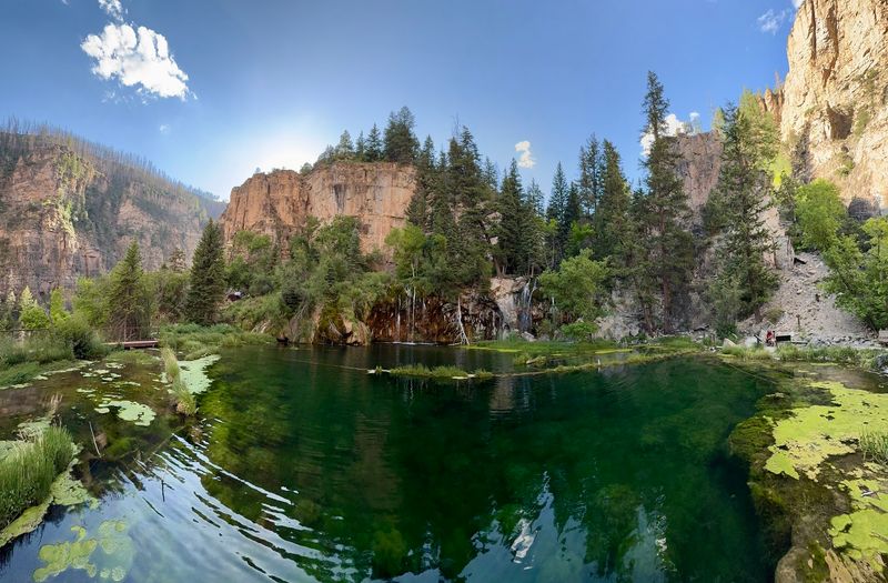
Colorado hides plenty of high-country wonders, but few pack such a big payoff into such a short distance. There is a spot where an emerald-green pool sits below towering cliffs, fed by cascades that spill straight over mossy ledges.
The trail up is compact, well built, and shaded for much of the morning, which means the reward feels close instead of impossibly far. Most people finish the whole thing in under two hours round trip, then spend a while soaking in the view up top.
It has become one of the most talked-about outdoor destinations in the state, and it earns that buzz honestly. Keep reading to learn where it is, how to snag a permit, and the small tips that make the visit go smoothly.
Where Colorado Tucks Away Its Emerald Pool
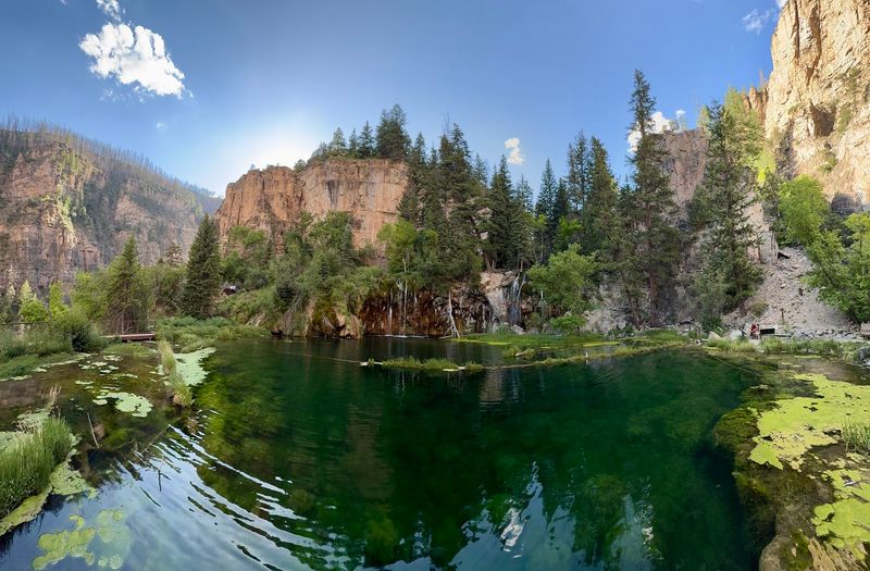
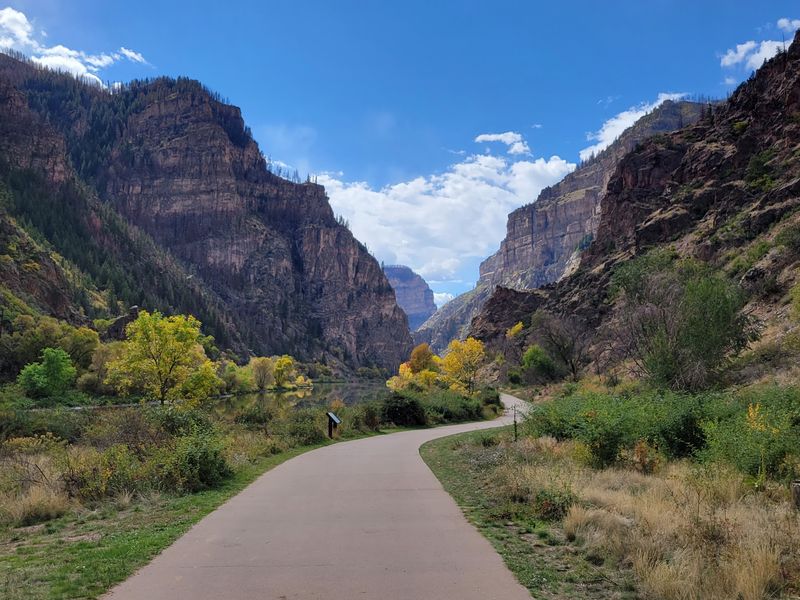
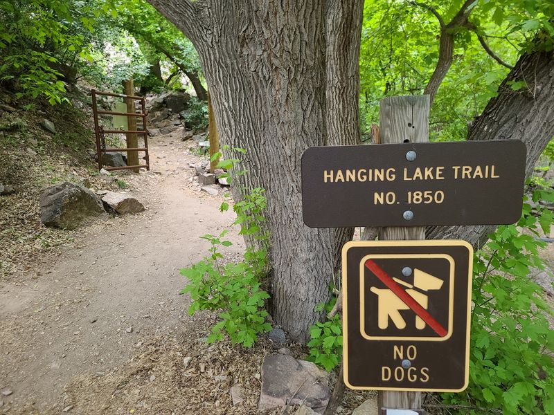
Right off Interstate 70 in Glenwood Canyon, the Hanging Lake Trailhead sits at 1-70 East of, Glenwood Springs, CO 81601. It is a hiking area tucked into the walls of one of Colorado’s most dramatic canyons.
The main attraction is a lake with vibrant green waters, cascades, and sheer cliffs rising all around it. You reach it by a steep hike or a shuttle bus that brings you to the base of the trail.
What surprises people most is how close all this beauty sits to a major highway. A short pull-off leads to a welcome center, clean restrooms, and a ranger checkpoint before the climb begins.
The lake rests at roughly 7,100 to 7,300 feet in elevation, and the trail gains around 1,000 feet in just over a mile. That combination of a compact distance and a big reward is exactly why it has earned a 4.8-star rating across more than 660 reviews.
Few roadside stops in the state deliver this much scenery for so little driving.
A Trail Rebuilt After Fire And Floods
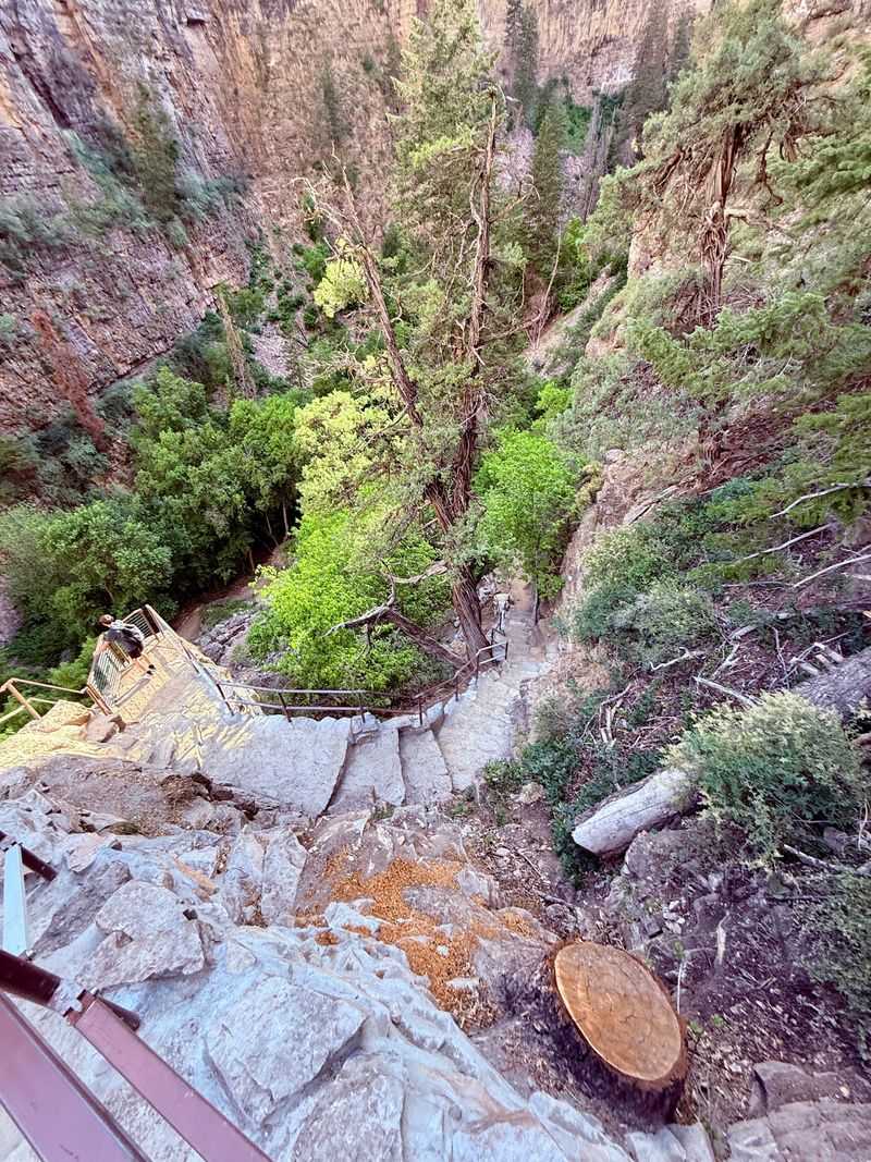
The path you walk today is not the same one hikers used years ago. After wildfire and flooding damaged the canyon, a large amount of money went into repairing and rebuilding the trail, and that work shows.
Regulars who returned after the restoration mention how impressive the improvements are. New wooden bridges replaced the older ones, and fresh stone steps line much of the route.
The lake itself carries a story of change too. Longtime visitors recall a deep turquoise color years ago, while today the water shows more of an emerald green, with bright, healthy algae visible along the bottom.
Crews have continued adding safety railings at the top, hauling heavy materials up the steep grade by hand. That ongoing care is part of why the site now runs on a reservation system, keeping crowds manageable and giving the delicate area room to recover.
Walking a trail that was carefully brought back to life adds a quiet sense of appreciation to the whole outing.
Seven Bridges And A Stone Staircase
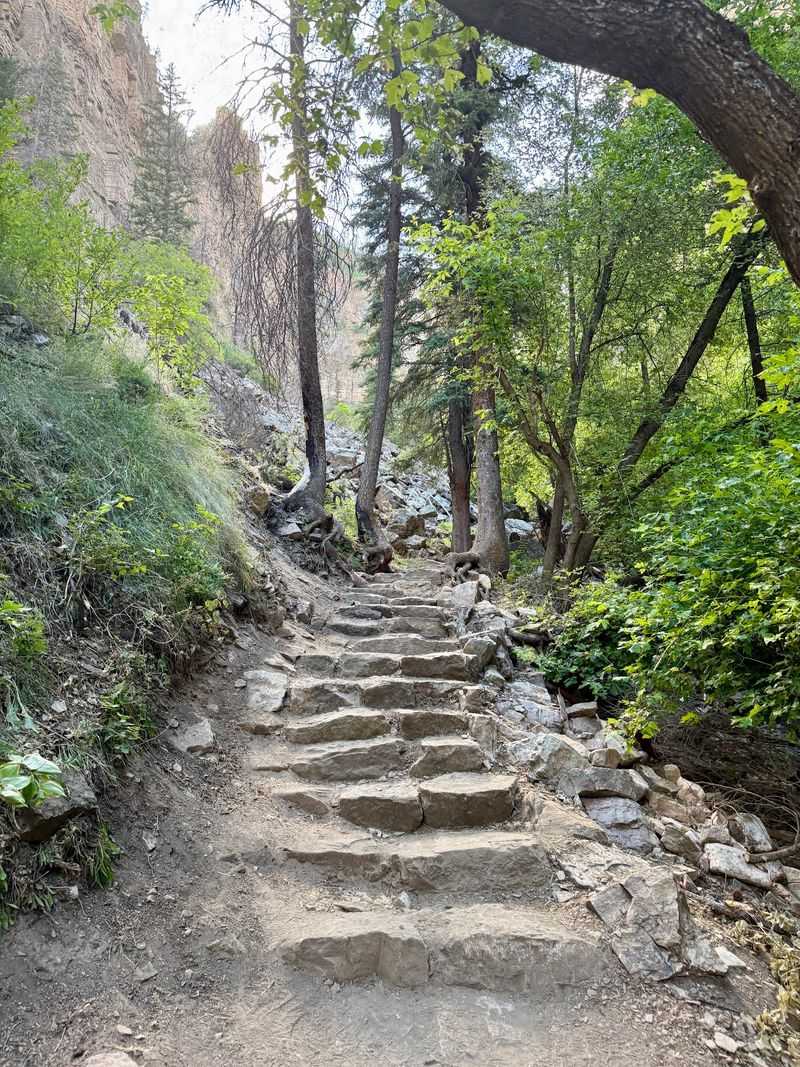
The route has a rhythm that keeps things interesting from the very first steps. You start out on stairs and a big rocky patch, then settle into a steady climb that gains elevation as it goes.
Along the way you cross seven bridges that span the creek, each one giving a natural spot to pause. Sitting areas built into the trail let you catch your breath without feeling like you are in anyone’s way.
Much of the upper section feels like climbing a well-made stone staircase. The steps are solid, though some are uneven, so steady footing matters more than speed.
People often describe the final stretch as the toughest part, essentially straight stairs for close to a mile. A small cave-like feature on the left signals you are roughly twenty minutes from the finish.
Counting off those bridges turns the ascent into a series of small milestones. By the time the seventh one is behind you, the payoff is nearly within reach.
The Waterfall Hiding Above The Lake
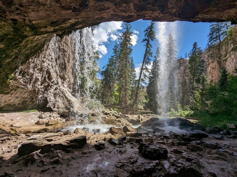
Reaching the lake feels like the end of the story, but the best surprise waits a little higher. A short climb of extra steps leads to Spouting Rock, a waterfall that pours directly out of the cliff face.
Many people call this upper feature the most impressive part of the whole trip. It sits only a few minutes above the lake, so skipping it would be a shame after all that climbing.
The lower cascades that feed the lake are lovely on their own, and together the two levels give you a double dose of falling water. Finishing the last 200 yards up to the top rewards you with something genuinely striking.
Wildlife tends to gather in this area as well, with marmots often spotted along the way to the upper falls. Birdwatchers have noticed western tanagers and other colorful species nearby.
Treat the lake as a checkpoint rather than the finish line, and Spouting Rock becomes the exclamation point on the day.
How Hard Is The Climb, Really
Opinions on the difficulty land all over the map, and both camps have a point. Some describe it as one of the most physically demanding hikes they have done, essentially a steady uphill climb for an hour and a half to two hours.
Others rate it easy to moderate, noting the trail is wide, well maintained, and short at roughly 2.7 miles round trip. The truth usually sits somewhere in between, depending on your fitness level.
Families do complete it. Kids around ages 8 to 10 have made it to the top, though it often takes plenty of breaks and encouragement along the way.
Timing gives a rough guide too. Many report about an hour up and 35 to 65 minutes back down, since the descent moves much faster than the climb.
The uphill is the challenge, plain and simple. Pace yourself, use the seating areas, and the stairs become far more approachable than they first appear.
Permits, Prices, And Reservations
Skipping the reservation step is the fastest way to derail your plans. Access is limited, and a permit purchased in advance is required to enter the trail.
The fee runs around $10 to $12 per person, checked by a ranger at the welcome center before you head up. Time slots can be tough to find, so booking well ahead, sometimes weeks in advance, is the smart move.
The reservation is tied to a specific window. People who tried to arrive hours early have been turned away and asked to come back at their booked time, especially during special events.
Those who showed up without a permit were generally sent back, though staff explained the process clearly and many simply returned the next day. Rangers on site also share trail information and route guidance.
A few minutes on the official website before your trip saves a lot of frustration at the gate. Lock in an early slot and the rest of the day falls into place.
Getting There Off I-70
The trailhead sits directly along Interstate 70 as it threads through Glenwood Canyon east of Glenwood Springs. That location makes it one of the easiest scenic stops to reach in the region.
The welcome center handles a quick ticket check, and parking has proven ample even for those arriving later in the day, around 12:30 in the afternoon. Early mornings fill up fast, though, so an 8:30 arrival on a busy weekend can mean grabbing one of the last open spots.
There is one quirk worth knowing. Because of the highway layout, travelers heading east may need to drive about four minutes west first, since there is no direct on-ramp going east after leaving the site.
A shuttle bus option also serves the trailhead for those who prefer not to deal with parking. Clean restrooms and drinking fountains sit near the lot, making it an easy place to reset before or after the climb.
Plan the exit as carefully as the entrance and the logistics stay stress-free.
What To Pack And When To Go
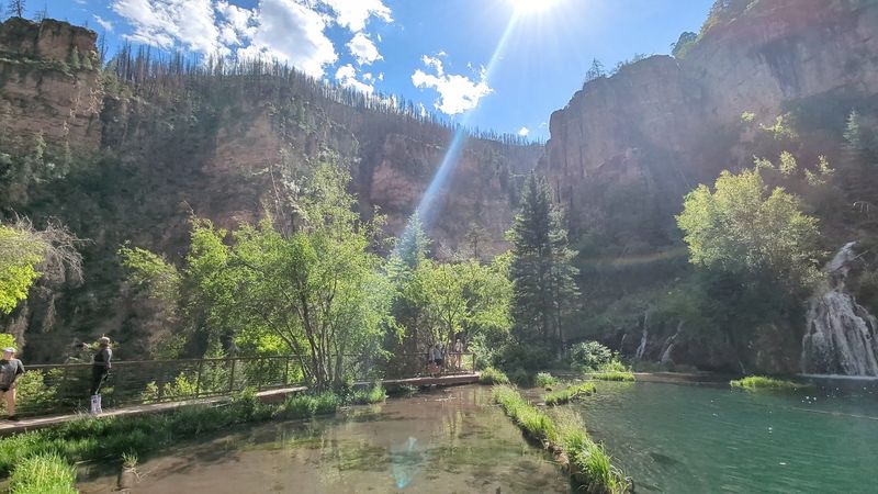
A little preparation turns a tough climb into a comfortable one. Water tops the list, with recommendations of around three to four bottles per person given how long and uphill the route is, especially on warm afternoons.
Trekking poles come up again and again, particularly for older hikers or anyone wanting extra stability on the uneven rock steps. Knee braces can help on the descent too.
Footwear matters more than fashion here. Sturdy shoes handle the stone staircase well, while heels and slick soles do not, so leave the fancy boots at home.
Timing is its own strategy. Much of the trail stays shaded from roughly 9 a.m. to noon, which keeps the harsh sun off you during the steepest sections.
Bug spray and long sleeves get suggested for the warmer months. Winter visitors have found crampons useful on a few icy spots.
Pack for the season, start early, and the mountain does the rest.
Why The View Wins In The End
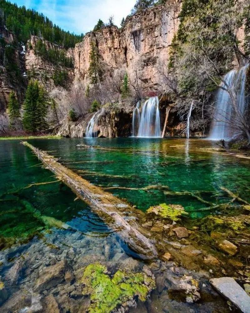
Every steep step fades from memory the moment the lake comes into view. The emerald water, the cascades, and the sheer cliffs combine into a scene that people repeatedly call worth every bit of the effort.
Sunlight hitting the surface makes the color glow, and many rank it among the best alpine lake hikes they have ever done. A seating area up top invites you to linger and take it all in before heading down.
The suggestion that comes up often is simple. Climb up steadily, then give yourself a full hour at the top to enjoy the lake and the valley view before the easy trip back down.
It is a rare combination: a short, well-built trail, a striking reward, and a setting just off the highway that many drivers speed right past. Those who stop rarely regret it.
Book a slot, lace up good shoes, bring plenty of water, and this compact Colorado climb pays back far more than it asks. The emerald pool at the top is waiting.
Enjoyed this story?
Add Fast Food Club as a preferred source to see more of our reporting on Google.