


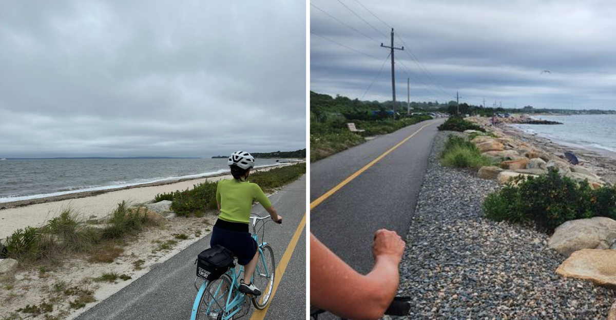
There is a stretch of paved path on Cape Cod that carries riders past salt marshes, sandy shorelines, and glassy ponds without a single hill worth complaining about. Once a railway line that ran all the way to a ferry dock, it now belongs entirely to cyclists, joggers, and anyone pushing a stroller for a lazy afternoon.
The best part might be the ending, where a short boat ride can whisk you and your bike off to an island for more exploring. What makes this trail so beloved, and why do people ride its full length twice in one day?
Read on, because the surprises stack up mile after flat, friendly mile.
A Falmouth Path With Coastal Roots
Tucked into the town of Falmouth, Massachusetts, the Shining Sea Bikeway stretches across Cape Cod as a fully paved recreation route open to bikes, joggers, walkers, and seasonal cross-country skiers.
The trail runs roughly 10.7 miles from north Falmouth down to the ferry dock in Woods Hole. Riders who make the return trip often log around 20 miles, and a few adventurous types tack on extra loops to hit 23.
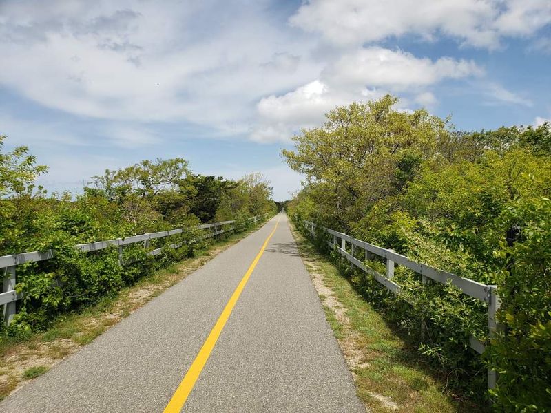
What sets this route apart is variety packed into a short distance. One moment the path glides through shaded woods, the next it opens up beside marshes, ponds, and the shoreline.
Because it follows an old railway bed, the grade stays remarkably gentle. The steepest incline is barely noticeable, which makes it welcoming for families and younger riders alike.
Free parking sits at the northern end, with several additional lots scattered along the way. That easy access is a big reason people keep coming back for another go.
From Train Tracks To Trail
Long before cyclists claimed it, this corridor carried trains all the way to the ferry landing at Woods Hole. The rail line served the region until the tracks came out around 1975 to make room for a recreation route.
Bits of that history still peek through. In a few spots you can spot remnants of the old train tracks, quiet reminders of the era when steam and steel moved along this exact path.
The railway heritage explains the trail’s easygoing character. Rail beds were built flat and steady, so the modern path inherited a grade that rarely rises more than a single degree.
Naming the route after the sea it hugs was a fitting touch. The corridor keeps its old purpose of connecting travelers to that ferry, only now the passengers arrive on two wheels instead of aboard a locomotive.
History buffs enjoy piecing together the timeline while they ride. It turns a simple outing into a small journey through the past.
Marsh Views And Wetland Wonders
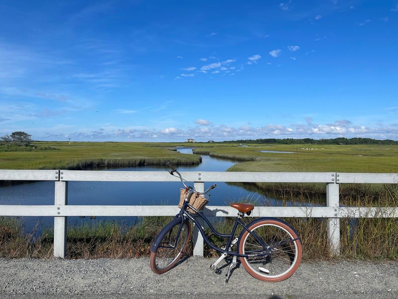
Salt marshes rank among the trail’s most talked-about features, and for good reason. The stretch just south of the West Falmouth parking lot rolls right through open wetlands where the grasses spread out in every direction.
Marshy sections give the ride a wild, untamed feel. The path threads between reeds and water, offering wide sightlines that shift with the seasons and the tides.
One friendly warning worth remembering: poison ivy grows near some of the marsh edges. If you stop to rest, choose your leaning spot for the bike carefully and stay on the paved surface.
Birds and wetland life keep the scenery lively. The mix of freshwater ponds and coastal marsh supports a range of creatures that add movement to the view.
For riders chasing a change of scenery, the marsh corridor delivers. It stands in easy contrast to the shaded woods and the open beach found elsewhere on the route.
Ocean And Beach Stretches
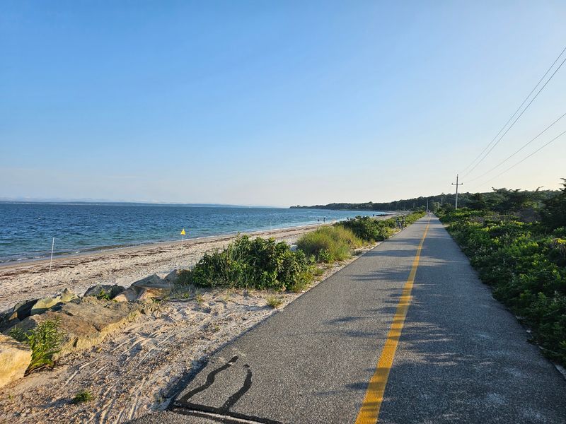
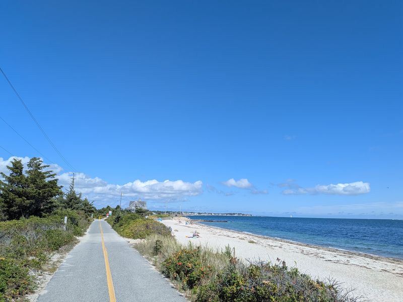
The section that gets riders most excited runs beside the water. A generous stretch of the path traces the ocean, with beach access popping up along the way for a quick pause or a swim.
Regulars often name the run between West Falmouth and Woods Hole as the most scenic. A pleasant strip of beach appears a little north of Woods Hole, right where the coastline shows off best.
Swimming is part of the appeal here. Plenty of spots let you hop off the bike, cool down in the water, and climb back on refreshed.
The southern coastal portion draws comparisons to shorelines far beyond Cape Cod. It has a way of feeling both familiar and a little exotic at the same time.
Even on a sunny summer weekend, this ocean stretch can stay comfortably uncrowded. That combination of open water and elbow room keeps people returning for the same view.
The Woods Hole Finish And Ferry Connection

Reaching the southern end feels like arriving at a real destination rather than just a trailhead. The path wraps up in Woods Hole, right near the ferry that runs to Martha’s Vineyard.
That connection opens up a bigger adventure. Riders can pedal the full length, roll their bikes onto the boat, and keep exploring the island trails once they land.
Woods Hole itself makes a natural spot to pause. The little harbor town has several cafes and eateries, including a well-loved bakery that draws cyclists in for a treat before the ride back.
Grabbing a bite here breaks up a round trip nicely. Many folks start at the north end, coast down to Woods Hole, refuel, and then turn around for the return leg.
The ferry finale gives the whole route a sense of purpose it might otherwise lack. Few rail trails end quite so dramatically at a working boat dock.
Built For Every Kind Of Rider
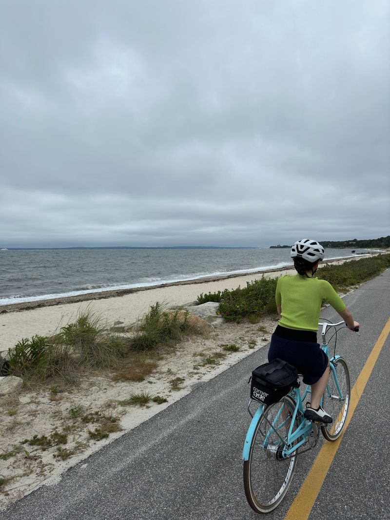
Few trails suit such a broad crowd. The nearly flat grade and smooth pavement make it friendly for casual cruisers, serious cyclists, joggers, and dog walkers all at once.
Families with younger children find it especially manageable. With no real hills to conquer, small legs can handle long stretches without wearing out.
Safety adds to the comfort level. The route stays almost entirely car free, crossing only a few small roads and never forcing anyone to ride alongside traffic.
A painted line separates northbound and southbound flow, keeping the busy sections organized. Most people respect it, though a few wanderers drift across now and then.
The path can feel a touch narrow on a crowded day, particularly where people gather to take in a view. Even so, the overall setup keeps things moving smoothly for everyone sharing the pavement.
Amenities, Signs, And Little Extras
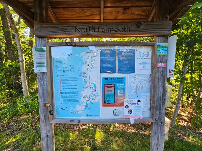
Thoughtful touches turn a simple ride into an easy outing. Bathrooms, water fountains, bike pumps, and occasional picnic tables show up along the way, so you can pause without hunting for supplies.
Signage guides riders throughout the route. Informational panels dot the corridor, and playful signs add a bit of personality to the journey.
Mile markers help with pacing, though they follow their own quirky logic. You might spot readings at odd intervals like 8, 8.1, 8.4, 8.6, and 8.7, which keeps distance-tracking interesting.
Art fans get a treat too. Various works of art are scattered along the path, giving your eyes something new between the natural scenery.
Maintenance stays a clear priority. Sections have been recently repaved, large cracks are marked with bright orange circles, and many parking lots offer water bottle refill stations for a convenient top-off.
Why This Ride Earns Its Fans
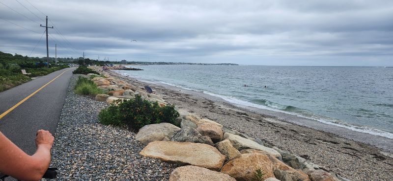
Holding a 4.4-star rating across more than sixty reviews, this bikeway has built a loyal following. People describe it as one of the finest trails around, and many ride the full length more than once in a single day.
The constant change of scenery keeps things fresh. Woods give way to marsh, marsh opens to beach, and quiet ponds appear where you least expect them.
Ease of access seals the deal. Free parking at the north end, several lots along the route, and simple bike rentals in Falmouth center make starting a breeze.
Well cared for and gentle underfoot, the path rewards beginners and seasoned riders alike. There is a reason folks call it the best trail in the area.
Anyone spending time near Falmouth would do well to set aside a few hours for it. Between the coastline, the wetlands, and the ferry at the far end, this stretch of old railway delivers a memorable day for miles.
Enjoyed this story?
Add Fast Food Club as a preferred source to see more of our reporting on Google.