


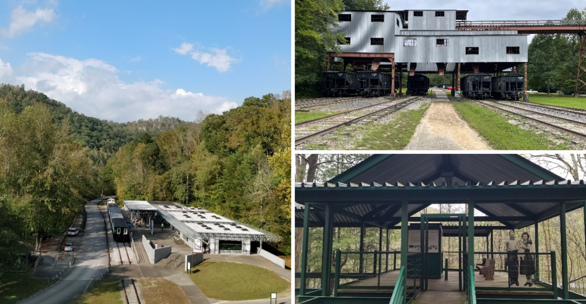
Deep in the Kentucky woods sits a town that emptied out decades ago, yet still tells its whole story to anyone willing to make the drive. Wooden frames stand where houses, a church, and a school once held a busy coal community together.
Push a button at each open-air station and recordings of the people who actually lived there fill in the details of camp life. A paved trail winds up a hill and out onto a bridge that stretches high above a river.
What follows is a full look at this open-air museum, its history, its standout features, and everything you need to plan a smooth visit.
A Coal Town That Refused To Disappear
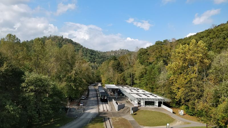
Tucked along the Big South Fork River, the Blue Heron Mining Community sits at Blue Heron Rd in Stearns, Kentucky, deep inside the Big South Fork National River and Recreation Area.
The National Park Service runs the site, and it stands as an outdoor museum rather than a typical building tour. Coal operations ran here from 1901 until 1979, and after the camp closed the buildings faded away.
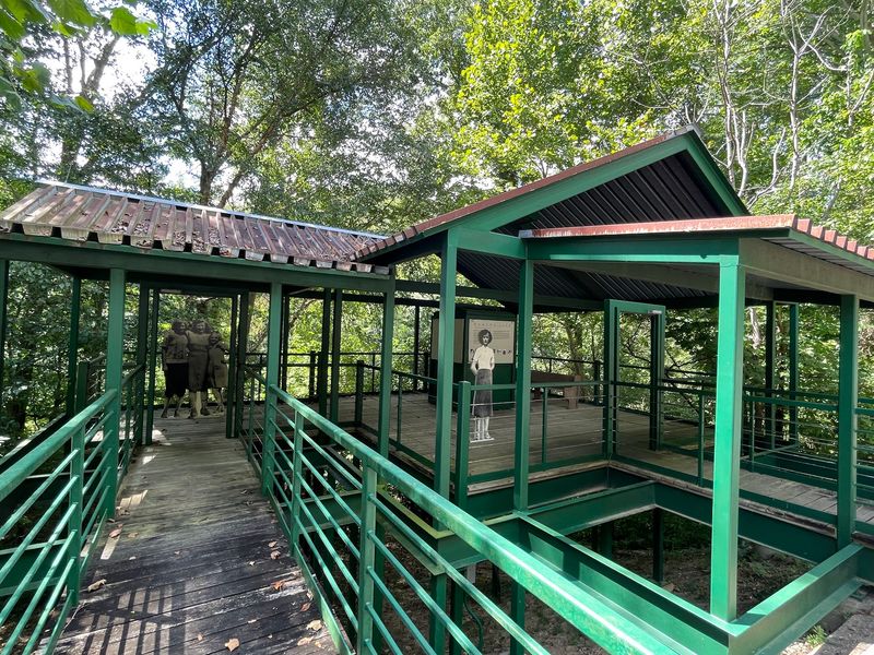
Instead of rebuilding the original structures, the park created open steel-and-wood frames that mark exactly where each building once stood. Locals often call these the ghost buildings, and they give the whole place its unusual character.
Everything is largely self-guided, so you can move at your own pace through the marked stations. The setting is remote, which is part of the appeal for those who want history without crowds.
Rated 4.7 stars across hundreds of visits, it has earned a strong reputation as a genuine find in this corner of the state. For anyone tracing Kentucky’s mining past, this is a place where the story stays remarkably present.
Voices From The Camp, Told In Recordings
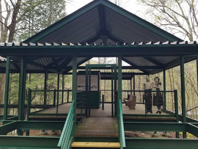
What sets this site apart is how the story gets told. At each open frame, an information plaque explains what the structure used to be, and most stations include audio you can trigger with the push of a button.
Take a seat and listen, and you hear former camp members describe daily life in their own words. Recordings cover different aspects of the community, from work in the mine to the everyday routines of families who lived on the ridge.
The presentation is thoughtful and clearly well planned, with a lot of care put into the interpretation. Interpretive stations dot the whole property, giving visitors plenty to read and hear.
A few of the audio buttons may not always work, and some signs have taken damage over time, so patience helps. Even so, the depth of information here is a highlight that regulars mention again and again.
The approach turns a quiet clearing into a living record. History feels less like a plaque and more like a conversation across the years.
The Skeletal Buildings And Their Quiet Spell
Frame after frame rises from the ground where homes, a church, and a school once stood. None of the original buildings remain, so the park uses these bare outlines to show the footprint of the vanished town.
Board cutouts of people appear in some of the structures, adding a curious touch when the grounds are empty and still. Many find this eerie in the best way, especially on quiet mornings with few others around.
Walking among the frames gives a clear sense of how the community was laid out. Each stop connects to a specific role the building played in camp life.
The design lets your imagination fill the empty spaces while the plaques and audio supply the facts. It is history you move through rather than history behind glass.
Small reminders of the past still turn up on the ground. Look carefully and you may spot little pieces of coal scattered here and there, quiet leftovers from the working years.
The Bridge High Above The River
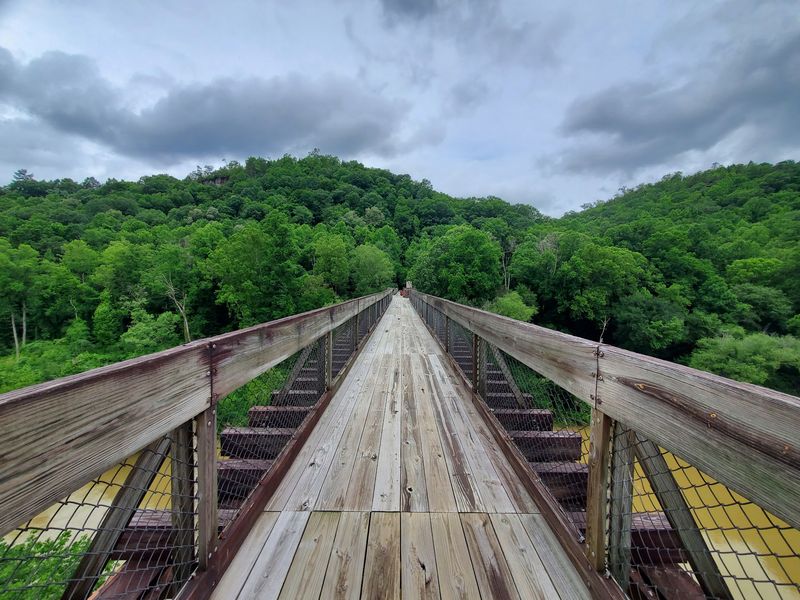
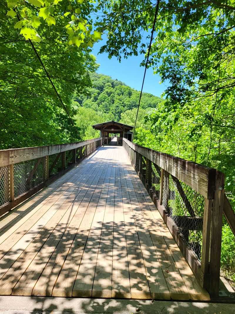
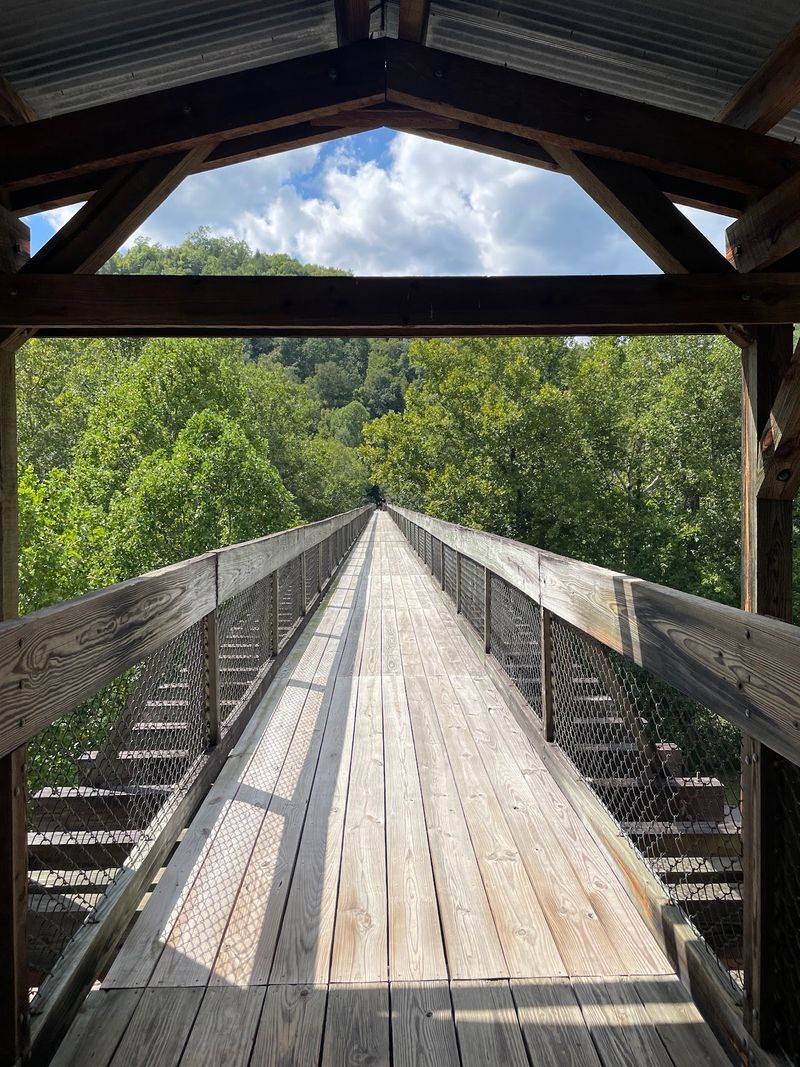
Near the old train cars, a structure doubles as a bridge that carries you out over the river. Many arrive without realizing the crossing is even there, then discover it is one of the finest parts of the whole visit.
The span sits very high above the water, and the views over the gorge draw a lot of praise. Regulars often call it a must-do part of the trail.
Because it climbs so high, those uneasy with heights may want to skip this section. The rest of the site still offers plenty without it.
Wildlife sometimes makes an appearance from up top. On a lucky day a bald eagle might be perched in a nearby tree, close enough to notice easily.
One important note before you plan around it: the Tipple bridge has been closed at times for structural repair, and access can change. Check current conditions so you know what to expect when you arrive.
Trails That Stretch For Miles
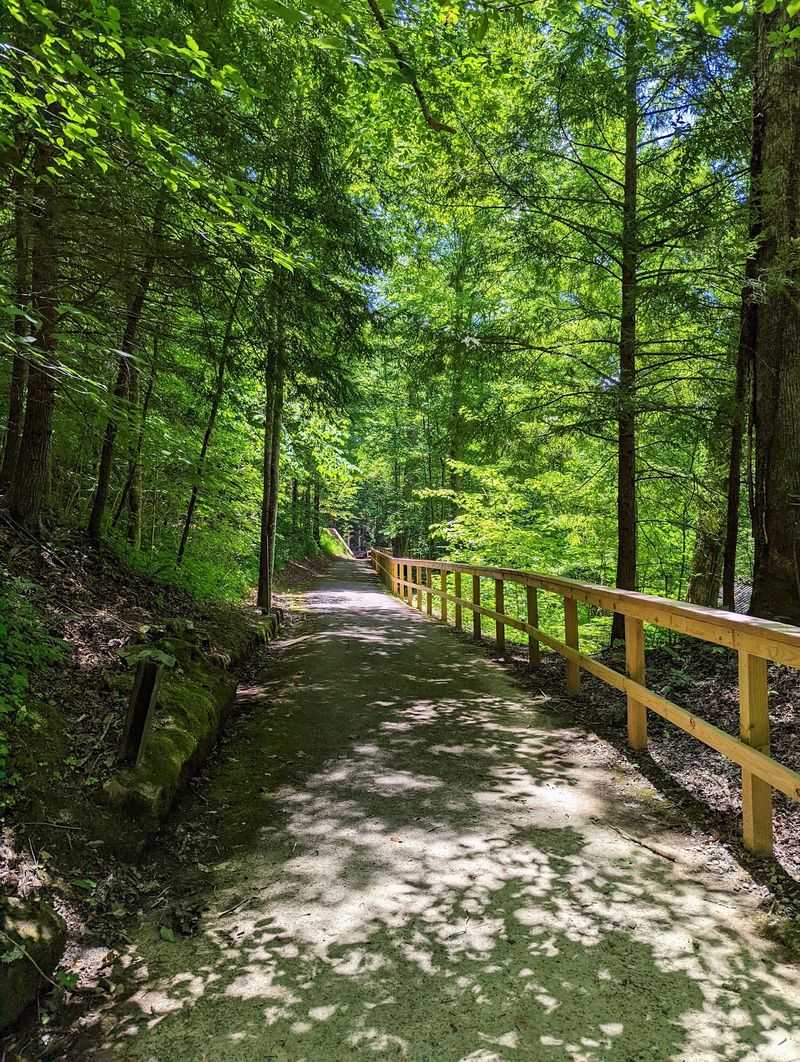
Hiking is one of the biggest draws here, mentioned more than almost anything else. The site connects into the broader Big South Fork trail system, so short strolls and long treks both start from the same area.
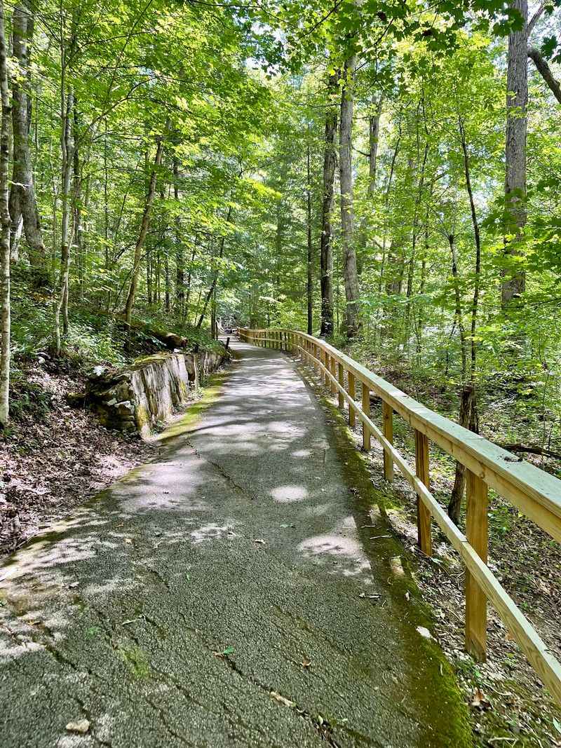
A paved path leads up the hill toward the mine entrance, and while parts are steep, the surface makes the climb manageable. The pavement also means mobility scooters can navigate much of the route.
Beyond the core loop, trails fan out across the surrounding forest. Some regulars return every holiday weekend and still have not covered every path, with routes running seven miles and more.
The core walk through the community itself is compact, taking roughly an hour to see at a relaxed pace. Longer hikes reward those who want a full day outdoors.
Plenty of shade lines the trails, which helps on warmer days. Bring good footwear for the inclines and you will find miles waiting to be explored.
Riding The Scenic Railway In

Getting to the community can be an adventure in itself. From Wednesday through Sunday, a train departs from Stearns and carries passengers out to the mining camp.
The ride is a favorite memory for families who brought young children years ago, and the trip is often described as interesting and well designed. It adds a sense of occasion to the day.
Taking the train is not required to see the site, since you can also drive in. Some choose to skip it because the fare has run over one hundred thirty dollars, which feels steep for certain budgets.
Others find the journey well worth it for the scenery and the experience of arriving the way visitors once did. Both approaches lead to the same rewarding walk through the frames.
Weigh the cost against the memory you want to make. Either way, the destination stays the same, and the road offers its own scenic run.
Rangers, Picnics, And Family Learning
Families tend to leave here happy, and the site works well as an educational outing for all ages. Children stay engaged with the push-button stations and the open frames to explore.
A park office sits on the grounds, and rangers get consistent praise for being helpful. When the bookstore is closed, they have been known to assist with passport stamps and answer questions.
Junior ranger activities tie into the wider Big South Fork program, giving kids a mission as they walk. Just note that construction or closures can occasionally affect certain platforms or questions.
Picnic tables and a few grills make it easy to turn the trip into a leisurely afternoon. Packing your own meal is a smart plan given how remote the setting is.
The mix of learning, walking, and open space suits multi-generation groups nicely. It rewards those who slow down and take the whole place in.
Hours, Cost, And Getting There
Good news on the wallet: admission to the site is free, which makes the long drive easier to justify. That value comes up often among those who make the trip.
The grounds stay open to the public year round, though the bookstore, gift shop, and concession stand run only in season. Posted hours list 11 AM to 4 PM daily, so plan your arrival accordingly.
The location is genuinely off the beaten path, sitting well outside town along Blue Heron Rd. There is almost no cell service out there, so download directions before you go.
The access road includes some steep inclines on the way in and out, so drive with care. Ample parking waits at the end, with plenty of spaces even on busier days.
Restrooms are usually clean and easy to access, and heated and cooled facilities are available in normal conditions. During repairs, portable toilets have filled in, so expectations may need adjusting.
When To Go And Whether It Is Worth The Drive
Timing shapes the experience more than most sites. Fall brings some of the best scenery for photos, while spring and early May often mean quiet grounds with hardly another car in the lot.
Weekdays can be especially peaceful, letting you explore at your own pace, though the visitor center and shops may be closed midweek in the off season. That trade-off suits people who prefer solitude over full amenities.
Plan your visit based on what matters most to you. Some spend around an hour on the core loop, while others block out two to four hours to cover the trails, the bridge, and every station.
A word of caution: closures of the visitor center or the river bridge have left a few travelers disappointed after the long haul out. Checking current conditions ahead of time protects your day.
For history seekers and hikers alike, this vanished community rewards the effort it takes to reach it. Come prepared, come curious, and let the frames tell you their story.
Enjoyed this story?
Add Fast Food Club as a preferred source to see more of our reporting on Google.