


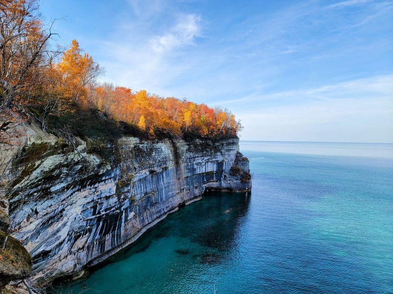
Somewhere along the northern edge of Michigan, the water turns a shade of turquoise that looks almost invented, and mineral-streaked cliffs rise straight out of a cold, clear lake. Trails wind for miles through hardwood forest, dropping past falling water and climbing to bluffs where the view stretches far past what feels reasonable for the Midwest.
Backpackers camp on the edges of these cliffs, families snap photos from easy platforms, and boat tours slip along a shoreline that shifts color with the light. What you will find here is a rare mix of remote wilderness and accessible beauty, all packed into one long stretch of Lake Superior coast.
Keep reading to learn where this place sits, what makes it worth the drive, and how to plan a visit that leaves you wanting a second trip before the first one ends.
Where Superior Meets the Sandstone
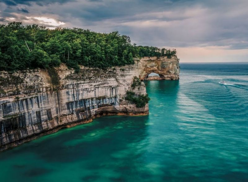
Way up in Michigan’s Upper Peninsula, this national lakeshore stretches along 40 miles of Lake Superior coast just outside the town of Munising. The main address to point your map toward is 1505 Sand Point Rd, Munising, MI 49862, where the shoreline and the trail system begin to unfold.
The park protects roughly 100 miles of trails that wind through northern hardwood forest before spilling out onto beaches, bluffs, and cliff edges. It is managed by the National Park Service, and the gates never really close since the park stays open around the clock, every day of the week.
What sets it apart is the combination. Few places in the Great Lakes region put towering colored cliffs, several waterfalls, sand dunes, and clear turquoise water within reach of the same weekend.
The name comes from those cliffs, streaked with mineral color that shifts between red, orange, yellow, and black depending on the light. With an average score of 4.9 stars across more than 8,000 pieces of feedback, the place has clearly earned its reputation as one of Michigan’s most treasured outdoor spots.
Cliffs That Change Color With the Light
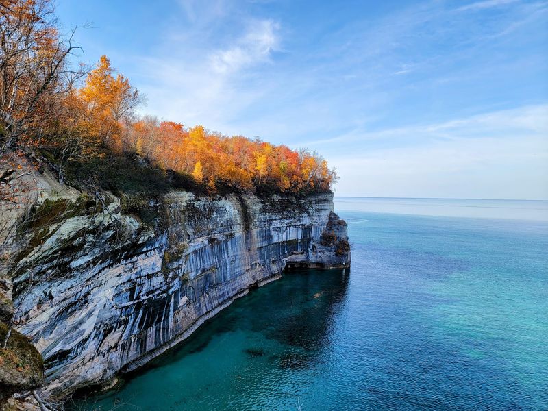
The famous sandstone walls are the reason the park carries its name, and they truly do resemble a painting hung along the water. Streaks of red, orange, yellow, and black run down the rock face, colors left behind by minerals seeping through the sandstone over long stretches of time.
Those tones do not stay fixed either. As the sun moves and clouds pass, the same stretch of cliff can look completely different an hour later, which is why so many people say the walls seem to shift with every change in light.
Backpackers who camp on the bluff edge above these cliffs describe the color as something that keeps pulling their eyes back. The water directly below adds to the effect, glowing in a blue that Lake Superior only produces under certain conditions.
Sandstone cliffs come up again and again in feedback about the park, and for good reason. They give this shoreline a look you simply do not find elsewhere across the region, and they anchor nearly every memorable view here.
Waterfalls Around Every Bend
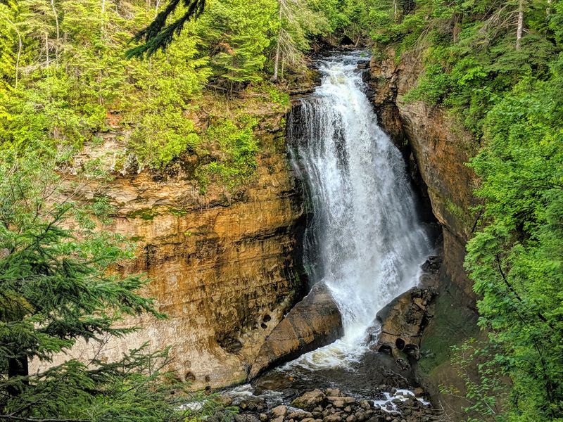
Falling water is one of the biggest draws here, and the park does not make you settle for just one. Munising Falls, Miners Falls, Sable Falls, Chapel Falls, and Mosquito Falls all sit within the greater area, giving hikers a whole collection to chase.
Some visitors point out that a few of the falls are more modest than the hype suggests, and that the surrounding UP has plenty of larger cascades if raw size is the goal. Miners Falls in particular gets described as best suited for families with small children rather than serious waterfall hunters.
Still, the sheer number keeps things interesting. Several waterfalls sit close enough to one another that you can string a handful together in a single day of exploring by car and short trail.
Waterfalls come up more than 300 times in comments about the park, which tells you how central they are to the experience. Whether you want a quick roadside stop or a payoff at the end of a long loop, there is falling water waiting somewhere along the way.
The Chapel Loop Adventure
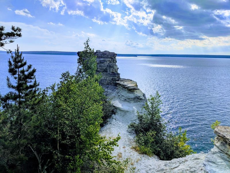
Serious hikers tend to circle one route above all others, and that is the Chapel Rock and Chapel Lake loop. Depending on where you start and how far you wander, it runs somewhere between roughly 6 and 12 miles, and it delivers panoramic views that many rank among the finest in Michigan.
The trail links Chapel Falls, the famous Chapel Rock, Chapel Beach, and Mosquito Beach, weaving between forest and open cliff edge. Along the coastal cliffs the walking turns almost dreamlike, though the sections in and out to the shore can get rough underfoot.
Folks who have done it recommend good shoes, plenty of water, and salty snacks for the effort. One smart tip that circulates is to head toward Mosquito Falls first, tackling the biggest elevation gain early rather than at the tired end.
Trail markers are sparse, so paying attention matters. Complete the loop and you walk away with what many call the best hike in the whole state.
Chapel Rock and Its Lonely Tree
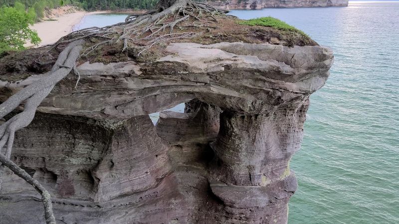
One landmark on the loop earns its own moment of attention: Chapel Rock, a sandstone formation crowned by a single tree. The pine grows on top of the isolated rock, its roots stretching across a gap to reach the shoreline, a quirky sight that surprises many first-time hikers.
People often describe it simply as a tree on a rock, and that plain description somehow makes it more charming. It has become one of the signature photo stops in the entire park.
Reaching it takes some work, since it sits along the demanding coastal portion of the Chapel route. The reward is a formation that feels genuinely one of a kind, framed by the blue water and colored cliffs beyond.
Even hikers who found parts of the trail challenging tend to agree the rock, the nearby falls, and the beach all made the miles worthwhile. It is the kind of small natural oddity that sticks in your memory long after the walk is over.
Miners Castle and Its Viewing Platforms
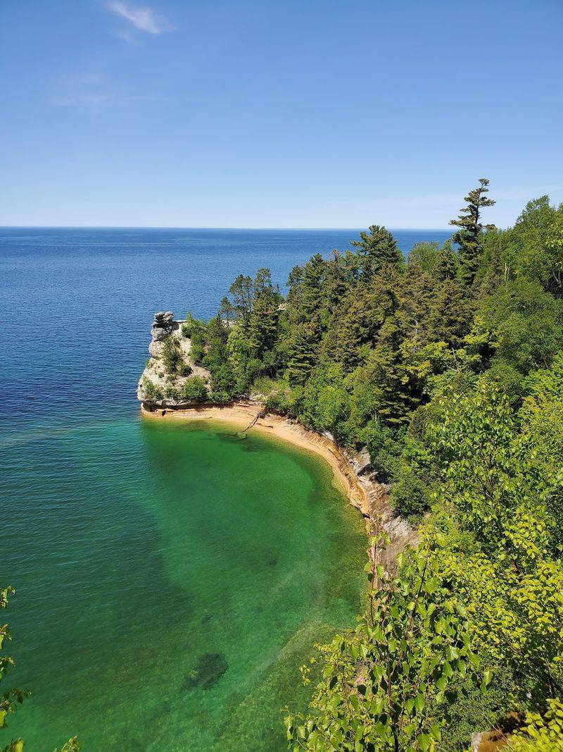
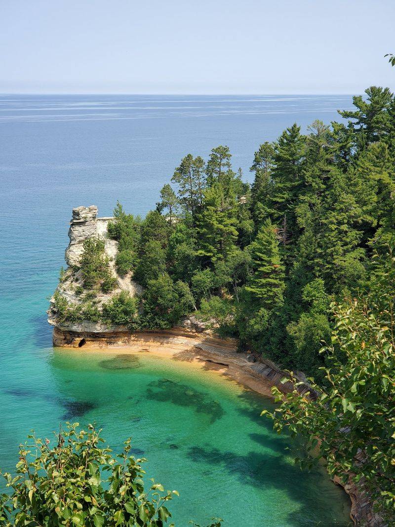
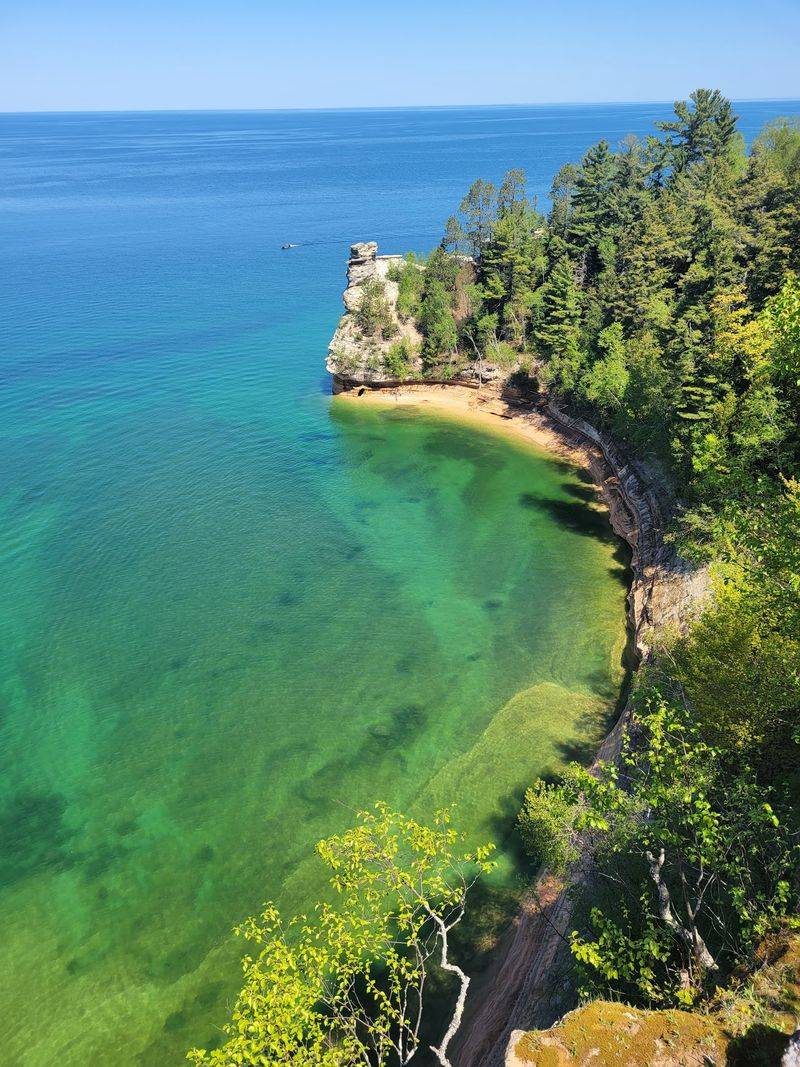
Not everyone wants an 11-mile trek, and Miners Castle is where the park welcomes the road-trip crowd. Drive up Miners Castle Road and you reach easy viewing platforms that look out over one of the most photographed rock formations on the shoreline.
There are two vantage points to enjoy. From the upper platform you look down at the curving rocks below, while the lower point lets you gaze back up toward the top, each offering a different angle on the same dramatic scene.
A ranger station sits nearby, and free guided geology talks are sometimes offered right at the formation. Kids can earn ranger badges here, which makes it a favorite stop for families.
The setting is so striking that people have gotten engaged at these overlooks, calling the view breathtaking. For sightseers who want maximum scenery with minimal effort, this spot delivers the postcard without the sweat.
Miners Beach and That Turquoise Water
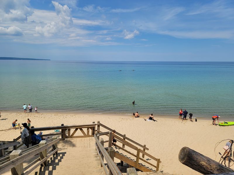
Skip the falls if you must, but do not skip Miners Beach. That advice comes up often, and the reason is the water, which glows in a pristine turquoise blue that catches people off guard the first time they see it.
Someone who spent over a decade living near the Pacific coast said that in summer you would struggle to tell Lake Superior apart from the ocean here. The clear, cool water and clean stones give the beach a look that feels almost tropical, at least until the temperature reminds you otherwise.
It makes a relaxed counterpoint to the harder hiking elsewhere in the park. Families spread out, walkers stroll the shore, and hikers finishing long loops sometimes reward themselves with a quick dip.
The beach pairs naturally with nearby Mosquito Beach for a full day of easy coastal wandering. Between the color of the water and the room to roam, it is one of the park’s most satisfying stops for anyone who just wants to slow down.
Seeing the Cliffs by Boat
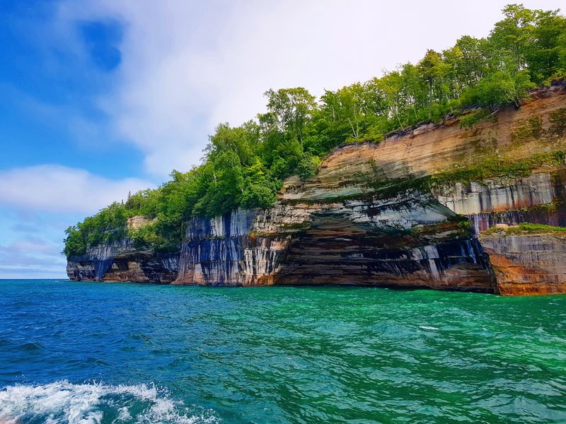
The cliffs look impressive from the trail, but the full shoreline reveals itself best from the water. Boat tours run along the coast, floating past picturesque spots like Rainbow Cave and Indian Head Rock that you simply cannot see from land.
A classic sunset cruise runs about 2.5 hours and has been priced around $50 per person, which people call solid value for the length and the scenery. One tip that comes up repeatedly is to bring a hoodie, since it turns cold on the water even in the heat of summer.
For those craving a little more thrill, the Riptide tour speeds along the same cliffs at a high clip, and the crew keeps things light with jokes. Bring something waterproof or a swimsuit for that one, because you may get splashed.
Renting a pontoon boat is another option for confident drivers who want to explore at their own pace. Boat tours draw hundreds of mentions, making them one of the most popular ways to take in the park.
Kayaking the Painted Shoreline
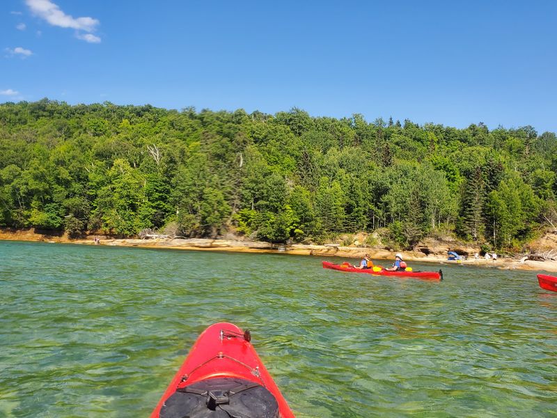
Paddlers get perhaps the most intimate view of all. Gliding a kayak along the base of the cliffs puts you right up against the mineral-streaked walls, close enough to trace the color changes with your own eyes.
The clear water makes the experience even better, since you can often see straight down through the blue as you paddle. Kayaking shows up around 158 times in comments, marking it as a favorite for people who want an active, up-close way to explore.
It is a bucket-list activity for many who make the trip, offering some of the most beautiful angles on the whole shoreline. The same coves and formations that boat tours pass become far more personal from a paddle craft.
Lake Superior is not to be underestimated, though, so calm conditions and proper preparation matter. For those ready for it, drifting beneath these cliffs is one of the most rewarding things you can do in the entire park.
Grand Sable Dunes and the Sand Point Side
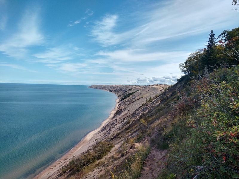
Cliffs and waterfalls get most of the attention, but the park also hides a stretch of towering sand. The Grand Sable Dunes rise near Sable Falls on the eastern end, adding a completely different landscape to the mix.
Climbing among the dunes offers wide views over Lake Superior and a change of pace from the forest trails. They pair nicely with a visit to Sable Falls, letting you knock out sand and water in a single stop.
Over on the Sand Point side near the visitor area, the shoreline turns gentle, with clear cool water and pretty stones scattered along the beach. A quick heads-up circulates about that spot: the stairs down to the beach can be covered in sand, and railings run out near the bottom, so watch your footing.
Together these areas prove the park is more than one trick. Between dunes, beaches, cliffs, and falls, the variety keeps every day feeling fresh.
Backpacking Above Lake Superior
For those who want to go deep, the coastline makes a memorable multi-day backpacking route. Trekkers set up camp right on the bluff edge, spending the night listening to Superior pushing against the cliff base below.
Late summer brings small pleasures along the way, like morning fog, foragable blueberries, mushrooms, and quiet sunsets over the water. The Upper Peninsula genuinely feels remote out here, the kind of remote that rewards the long drive north.
Weather deserves respect, though. Even in early August, nights can drop into the low 40s and rain can roll in, so packing warm layers is a smart move for anyone staying overnight.
Do not count on cell service either, since internet is basically nonexistent across much of the area. That isolation is part of the appeal, and it is why some backpackers call this the most visually distinctive and underrated hiking experience in the country.
Best Times to Make the Trip
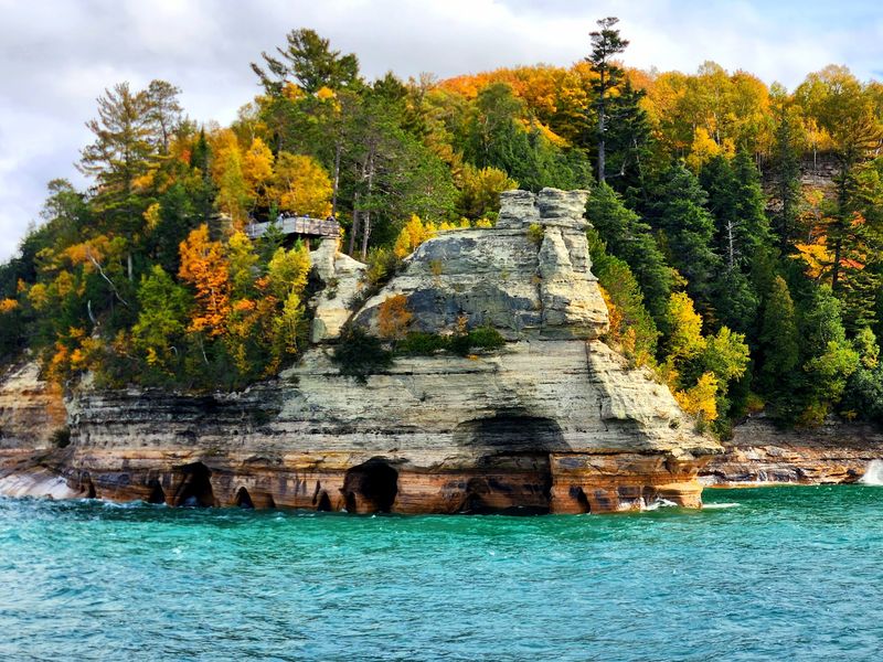
Timing shapes the whole visit here, and summer is the classic window. July and August bring the warmest water and the tropical-looking turquoise that people rave about, making it the go-to season for beaches and paddling.
Fall earns strong praise too, when the hardwood forest turns and the crowds thin out. Even quieter is early to mid November, when one hiker found the Chapel Loop nearly empty and had no trouble with parking.
Spring has its own charm, though a Memorial Day weekend visitor warned that the pollen can be intense, so allergy medicine is worth tossing in the bag. Chilly, rainy stretches can pop up in any season, and a sweatshirt often earns its place in the pack.
Crowds peak in late August, when lots at popular trailheads overflow and roadside parking becomes the backup plan. Choosing the shoulder seasons trades a little warmth for a lot more solitude, which many find to be a fair deal.
Getting There and Practical Notes
Reaching this stretch of the Upper Peninsula takes some commitment, and that is part of what keeps it special. The park sits about 6 hours from Chicago, roughly 3 hours and 15 minutes from Green Bay, so most trips involve a proper road journey.
The lakeshore stays open 24 hours a day, seven days a week, so you can catch sunrise or a late arrival without worrying about gates. A daily vehicle fee applies, reported at around $25 per car, and it can be paid at the Munising Falls Visitor Center.
That visitor center is also where you can grab a national park passport stamp and get your bearings before heading out. Trail signage can be limited, with only a handful of markers on some routes, so downloading a map ahead of time helps since cell service is unreliable.
Pack water, snacks, sturdy shoes, and layers no matter the forecast. A little preparation goes a long way in a place this wild and this far from town.
Why This Shoreline Stays With You
Few places manage to be both wildly scenic and genuinely welcoming to every kind of visitor, yet this one pulls it off. Serious hikers get punishing loops and cliff-edge campsites, while families and road-trippers get easy platforms, gentle beaches, and short falls within a quick walk.
The combination is what earns it a near-perfect standing among thousands of pieces of feedback. Couples come here to get engaged, longtime Michiganders return again and again, and out-of-state travelers cross it off their bucket lists and immediately start planning a return.
Whether you paddle beneath the painted cliffs, cruise past hidden rock formations at sunset, or simply stand on a beach where the water glows turquoise, the shoreline delivers on its promise. The drive north is long, the trails can be rough, and the weather does what it wants.
None of that seems to matter once the cliffs come into view. Pictured Rocks National Lakeshore stands as one of the most beautiful corners of Michigan, and it tends to leave people planning their next trip before the current one ends.
Enjoyed this story?
Add Fast Food Club as a preferred source to see more of our reporting on Google.