


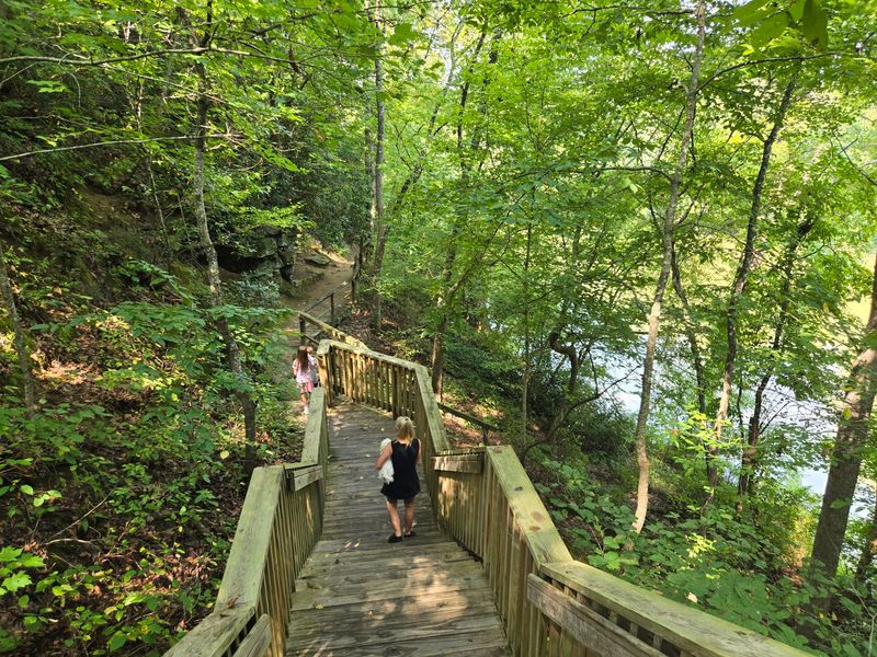
A long staircase drops through the trees toward a shallow rock shelter where a teenage pioneer once waited out his first winter, and most people driving through central North Carolina have no idea it exists. The story attached to this quiet spot stretches back to 1751, when a young Daniel Boone and his large family reportedly took cover here beside a wide, slow river.
Today the same ground holds hiking trails, a towering old tree, a riverbank walk, and a cave you can actually step inside. What follows is a full look at the history, the trails, the practical details, and what makes the descent worth every step down and every breath back up.
A Secluded Park Off Boones Cave Road
Tucked at the end of a rural drive, Boone’s Cave Park sits at 3552 Boones Cave Rd in Lexington, North Carolina, roughly a county over from the interstate crowds.
The 100-plus acres unfold along the Yadkin River, which doubles as a county line and gives the whole place its quiet, tucked-away feeling.
Regulars often call it the best kept secret in Davidson County, and the drive out is part of the reason. Some travel an hour or more just to reach the trailhead, and they tend to say the trip pays off.
You will find hiking paths, a river fishing area, a monument, and the cave itself, all wrapped in heavy tree cover that keeps things comfortable even on warmer days.
Nothing about the setting shouts for attention. There are no waterfalls and no mountaintop overlooks, yet many who wander in leave calling it close to perfect for a slow walk in the woods.
The Daniel Boone Legend Behind the Cave
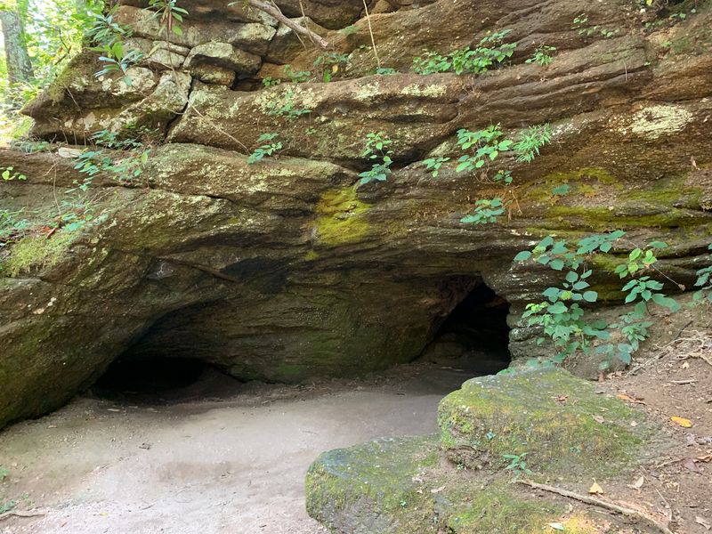
Long before it became a county park, this stretch of riverbank was reportedly a shelter for one of America’s most famous frontier families.
The story goes that in 1751, a fifteen-year-old Daniel Boone and his relatives took cover in these shallow caves after leaving Pennsylvania. The group is said to have numbered around 25 people, including all ten Boone children plus neighbors who traveled south together.
They are believed to have waited out their first winter here before building cabins nearby, later settling across the Yadkin River in what is now Davie County.
The park was formally established in 1909 by the Daniel Boone Memorial Association, and it carries the pioneer’s name to this day.
Whether every detail is exact or partly folklore, the sense of standing where a young frontiersman once sheltered gives the short walk a weight that plain scenery never could.
Down the Stairs to the Cave
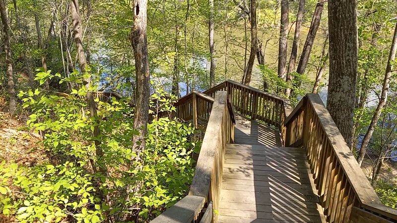
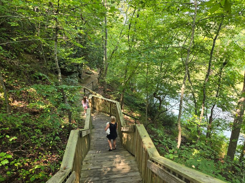
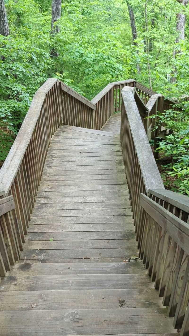
The main event starts with a descent, and there are a lot of steps involved.
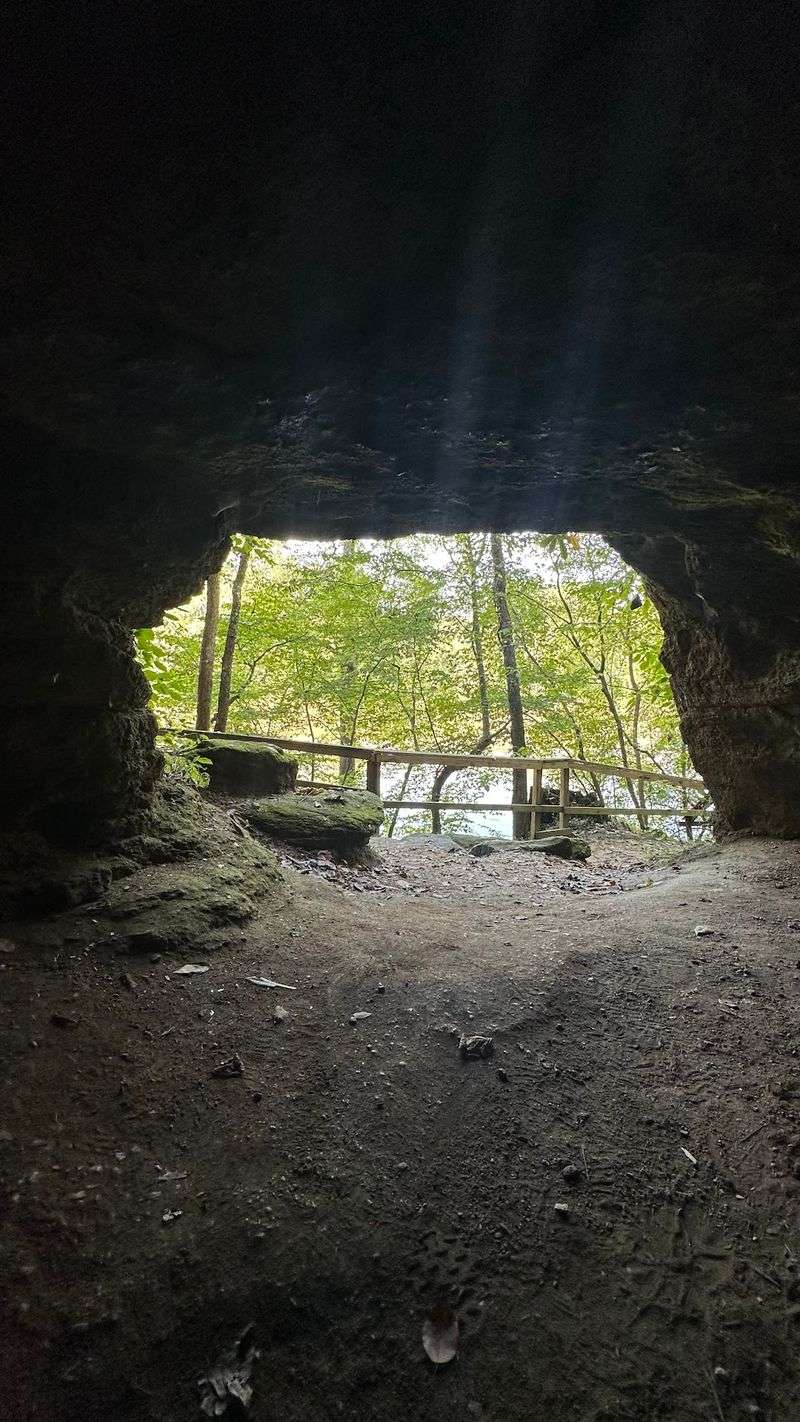
Multiple sets of stairs drop from the upper parking area down toward the cave, which overlooks the Yadkin River from the bottom of the slope. Regulars mention that going down is easy and coming back up will get your heart pumping.
The cave itself is modest. Some describe it more as a deep overhang than a true cavern, but it is roomy enough to shelter several people, and you can step inside if you mind your head near the low ceiling.
Kids tend to love it, and families make the round trip a quick outing when they are not up for a longer hike.
Signage can be a little confusing since some stone stairs have been closed off over the years, but people still find their way to the shelter without much trouble.
The reward at the bottom is a riverside spot rich with pioneer history, well worth the climb back.
Trails That Range From Easy to Strenuous
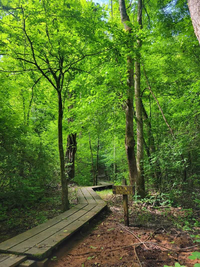
Beyond the cave, the trail network is where many spend the bulk of their day.
Paths here run the full range, from wide, easy walkways suitable for most ages to loops that people call fairly strenuous. Trails come up 127 times in conversation about the park, so they clearly earn their reputation.
The Wildflower Trail forms a loop of about 0.7 miles that starts near the cave stairs. Because it climbs and drops, that short distance can feel longer, and folks note it is not built for strollers, wheelchairs, or walkers.
Some hikers spend three hours out here and still leave with paths left to explore. Others tack on a walk to the playground just to round out a full mile.
Benches appear along parts of the route to give tired legs a rest during the elevation changes.
Whether you want a gentle stroll or a genuine workout, the layout lets you choose your own effort level.
Walking the Yadkin River Bank
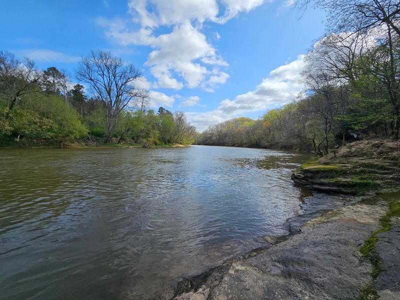
At the base of all those stairs, the Yadkin River opens up the whole scene.
You can walk right along the bank, where several trails branch off in different directions. The water is normally on the muddy side, especially after heavy rain when levels run high.
During drought conditions, though, the river turns clear and shows off a much prettier face. Timing your visit around drier weather can change the whole look of the place.
Small wildlife keeps things interesting near the water. Baby turtles paddling in the shallows are a common sight, and some people happily sit on the bank for hours just watching.
The river also serves as the county line, adding a bit of geographic trivia to the stroll.
For those who prefer unpaved paths and a natural setting over manicured parkland, this riverside stretch is a big part of the appeal.
The Giant Cottonwood and Red Oak Trees
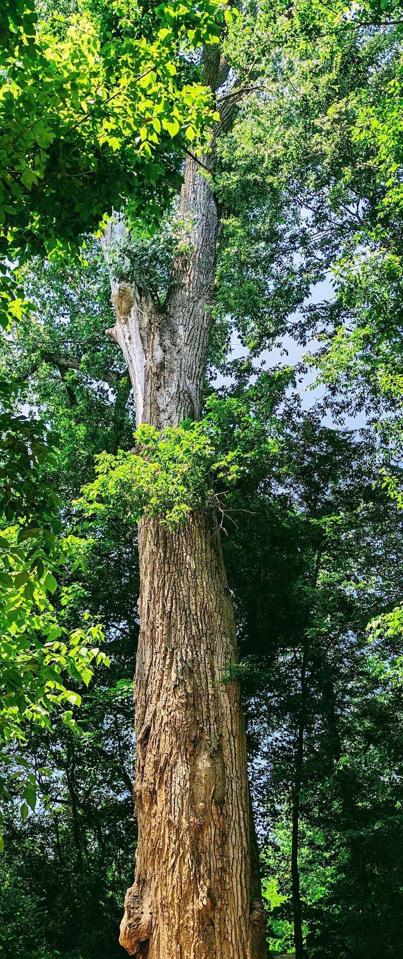
Some of the park’s biggest stars are rooted firmly in place.
The Cottonwood Trail leads far back along the river to a massive cottonwood believed to be the third largest of its kind in the state. Estimates put its height around 169 feet with a trunk roughly 16 feet thick and a canopy spanning about 109 feet.
People who have measured it up close describe a trunk five or six feet wide and an age north of 125 years. Large sections of bark have been falling away, so its future is uncertain, which makes seeing it now feel special.
Not far off stands a large Red Oak that some consider the prettiest tree in the whole park. Both giants have their own trails leading to them.
Grass can grow tall along the cottonwood path, so it may look a little wild in places.
These living landmarks give the walk a sense of scale that photos rarely capture.
Disc Golf, Playground, and Family Extras

There is more here than trails and history, especially for families and casual visitors.
A large disc golf course sprawls across the park, with baskets scattered along the more demanding trails. It is a big course, though a few holes border patches of poison ivy, so watch your footing.
Younger kids get their own spot too. A playground sits near enough to the upper area that you can park right beside it, which makes short visits with little ones easy.
Picnicking is popular, with a large sheltered area at the end of the road that has hosted birthday parties. Smaller picnic spots dot the grounds as well.
Tent camping areas add another option for those wanting to stretch a visit into an overnight.
A couple of vending machines near the restrooms cover quick refreshments, and a park ranger is often on site.
Between the frisbee tosses, the swings, and the shady tables, the day can go many directions.
Remnants of an Old Log Cabin
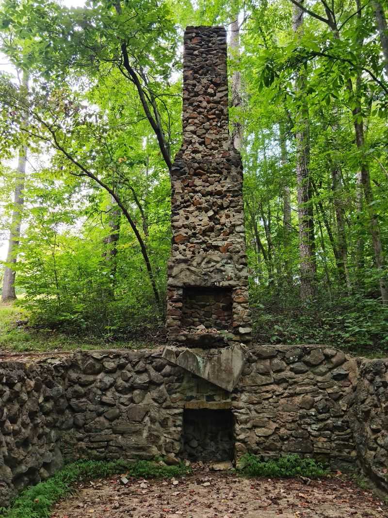
Tucked near the last parking lot sits a small piece of the past that is easy to miss.
What remains of an old log cabin is now just the stone foundation, believed to date to the 1940s. It stands close enough to the parking area that a short detour gets you there.
The stones tie neatly into the broader pioneer theme, echoing the idea of families building homes near the cave centuries earlier.
People who take the time to look often mention it as a quiet, worthwhile stop between the bigger attractions.
It will not take long to see, but it adds another layer to a park already stacked with history.
For anyone curious about how people once lived on this land, those weathered stones are a small but genuine reward.
Seasons, Mosquitoes, and When to Go
Timing makes a real difference at this park, and the seasons each bring something different.
Spring turns the Wildflower Trail into a highlight, with blooms lining the loop and a variety of mushrooms appearing through the woods.
Winter has its own quiet payoff. Icicles form on the rocks around the caves, and the view of the river from the top of the Winter Overlook Trail draws praise from those who bundle up for it.
Fall gets a nod too, with hikers planning return trips once the weather cools and the tree cover shifts color.
Then there is the summer warning that comes up again and again. Mosquitoes can be very bad, so packing repellent is strongly advised, along with a hiking stick for the inclines.
Heavy rain also muddies the river and raises the water, while dry spells clear it up.
Plan around the bugs and the weather, and nearly any season here rewards the effort.
Hours, Free Entry, and Getting There
Practical details are refreshingly simple at this county park.
Gates are open every day of the week from 9 AM to 5 PM, so plan your hike to wrap up before the afternoon close. Entry is free, which makes it an easy choice for a spontaneous outing.
The address is 3552 Boones Cave Rd, Lexington, NC 27295, and the park sits close enough to Salisbury to pair a hike with a nearby meal. Many drive out from more than an hour away and count it as time well spent.
Parking is limited near the trailheads, but you can pull off up and down the road once inside the park. Regulars suggest avoiding the spots by the stairs on the right.
Restrooms near the parking lot draw steady praise for being clean, and vending machines sit close by.
Bring a map, since the trails are only loosely marked. With a little preparation, the logistics rarely get in the way of a good day.
Enjoyed this story?
Add Fast Food Club as a preferred source to see more of our reporting on Google.