


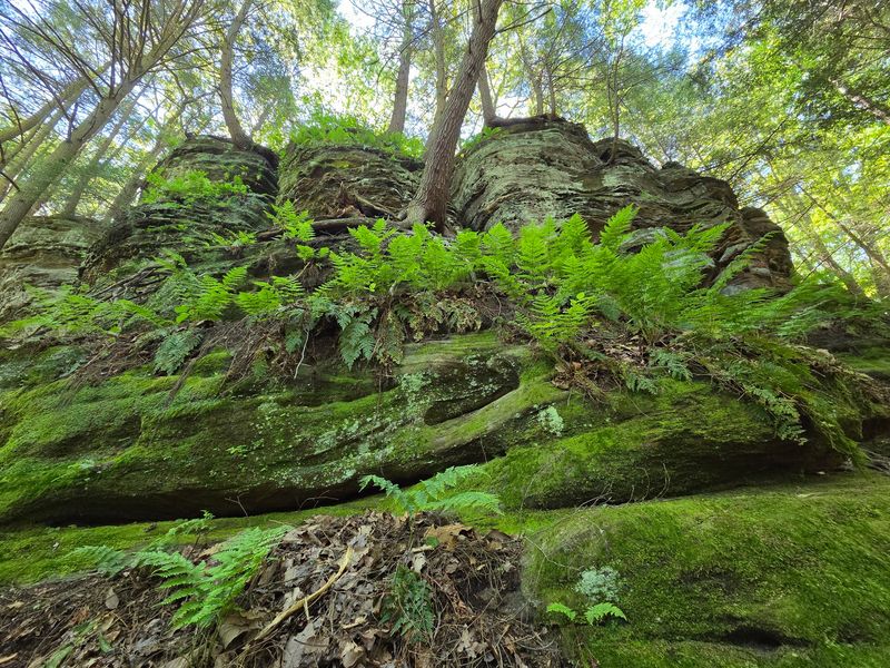
Some trails hand you their best scenery right away. Others make you work for it, dropping you down old stone stairs into a shadowed valley you never expected to find in Ohio.
That second kind is exactly what waits in the northern corner of Hocking Hills, where towering sandstone walls close in around a narrow passage that hikers have squeezed through for generations. The climbs are steep, the stairs are worn, and the payoff is a rugged, remote pocket of nature that feels far removed from the busier paths nearby.
What makes this spot so beloved, why does it feel wilder than the rest, and what should you know before lacing up your boots? Keep reading, because this hidden valley has plenty of surprises tucked into its cliffs.
Where The Valley Hides In Northern Hocking Hills
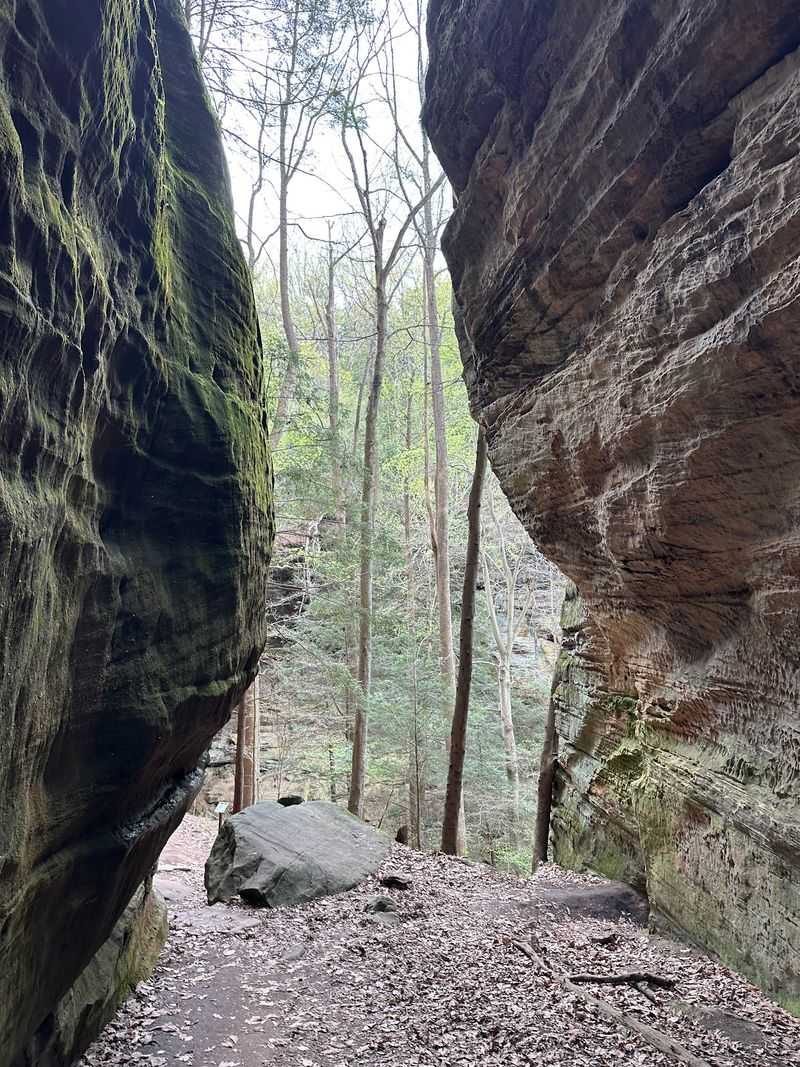
Tucked at 13640 OH-374 in Rockbridge, Ohio, this hiking area sits in the far northern reach of the Hocking Hills State Park region. It is one of the more distant stops in the group, which is a big part of why it feels so untouched.
The area is managed by the Ohio Department of Natural Resources, and it draws people looking for deep valleys, tall cliffs, and a genuine rock shelter carved into the stone.
Reaching it takes a bit of intention, since it is set apart from the crowds that gather at the more famous spots. That distance works in your favor, though.
Fewer cars fill the lot, which holds roughly thirty vehicles, and the trails often feel quiet. Regulars mention it is less crowded than other parts of the park, and that solitude adds to the whole experience.
With a strong 4.8-star standing across more than 1,700 opinions, the place has earned a loyal following. It is a hiking destination first and foremost, so come ready to move.
A Rock Shelter Shaped Over Countless Years
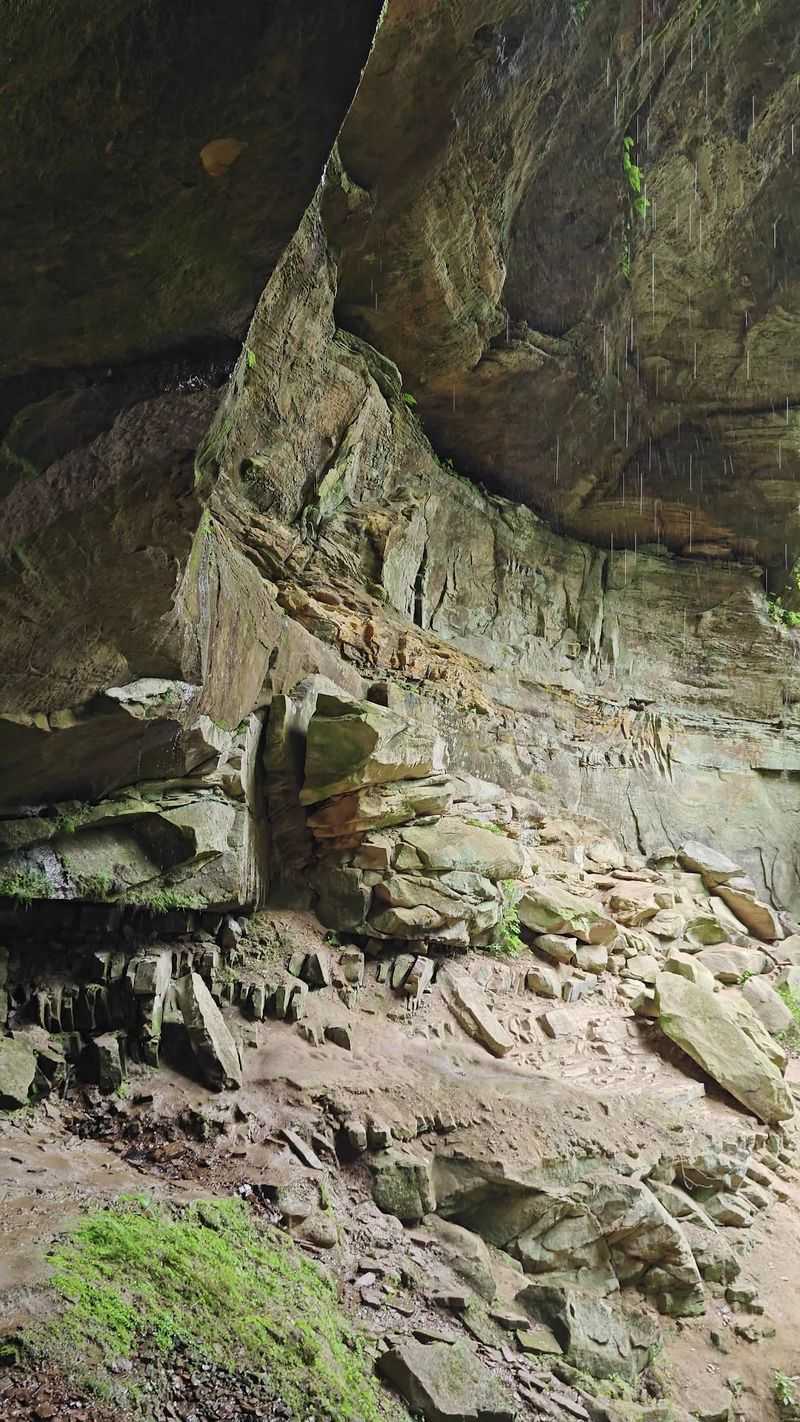
Long before hiking boots ever touched this ground, water and weather were slowly carving the sandstone into the shapes visitors admire today. The result is a deep recess in the rock, high cliffs, and a valley that feels sculpted by patience alone.
The area is known for its rock shelter, a wide stone overhang that anchors the whole landscape. Standing beneath those layered walls gives you a sense of just how much time it took to form them.
Sandstone features scatter across the trail, and part of the fun is exploring the nooks and formations along the way. Some folks describe it as rugged and wild, unlike the tamer paths elsewhere.
There is history layered into the stone stairs too. Built long ago, the cobblestone steps have worn down over decades, and many people see that aging as part of the trail’s character rather than a flaw.
A small picnic shelter sits about halfway through, another old piece of the site. Keeping it clean helps preserve that history for the hikers who follow.
The Famous Fat Woman’s Squeeze
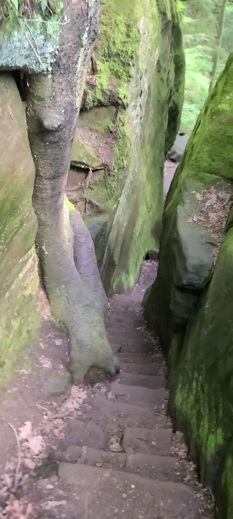
Every great trail seems to have a signature moment, and here it belongs to a tight little passage with a memorable name. The Fat Woman’s Squeeze is a narrow gap between towering rock walls that hikers thread through as they explore the lower gorge.
The squeeze has become a bit of a landmark, the kind of spot people look forward to finding. Some even joke about not being sure whether they passed through it or not, since the trail can get confusing.
Reaching it means dropping down into the gorge on the lower route, where towering rock walls press in close. It is the sort of feature that turns a simple hike into a small adventure.
The narrow passageways add to the sense that you have stumbled into a hidden corner of the world. Between the steep stairs and the tight gaps, this section keeps things interesting.
For anyone who loves poking around unique rock formations, this is the highlight worth slowing down for.
Two Trails, Two Very Different Views
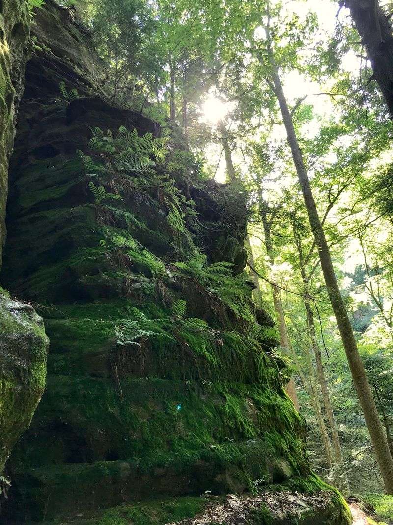
Not everyone wants the same kind of hike, and this area gives you a choice right from the start. There is a high route along the rim and a lower path that winds through the gorge, each offering its own reward.
The Rim Trail runs about three miles for those who take the longer loop, with tree roots and elevation to keep your legs busy. From up top, the views stretch out over the valley below.
Down low, the gorge trail leads past towering rock walls and past that famous squeeze. The lower route puts you right in the heart of the stone landscape.
Many people combine bits of both to get a full picture of the place. The mix of high overlooks and deep gorge walking is a big reason this trail stands out from its neighbors.
Trails here run one way in spots for safety, which helps manage the tricky terrain. Whichever direction you lean, both paths deliver scenery that keeps hikers coming back.
Stone Stairs That Test Your Legs
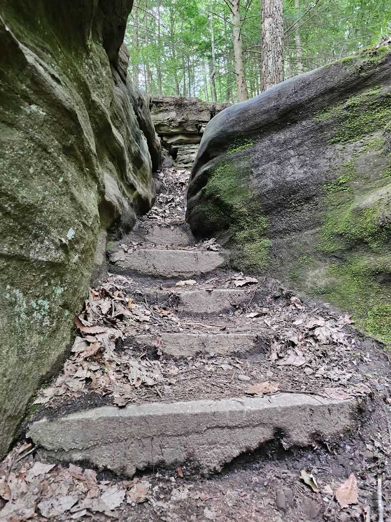
Talk to anyone who has hiked here and the stairs come up fast. The trail is loaded with steps, and they factor into nearly every account of the climb up and down.
The old cobblestone staircases have weathered over the years, leaving some sections uneven and a little precarious. People often advise caution and suggest staying close to the trail while picking your footing.
Despite the wear, the steps are part of what gives the route its rugged charm. Descending into the valley and climbing back out is a genuine workout, with a lot of ups and downs packed into a short distance.
In just over a mile, the elevation shifts more than four hundred feet. That number tells you plenty about why the stairs get so much attention.
Good footwear makes a real difference here, and a light pack with extra water helps. Take the steps at your own pace, and the trail rewards the effort with scenery worth every step.
Small Waterfalls And Quiet Creeks
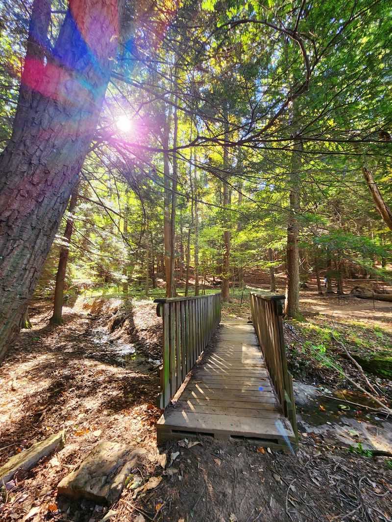
Water is part of the story here, quietly shaping the valley and adding little surprises along the way. Small waterfalls appear as you move through the gorge, and gentle creeks thread between the rock walls.
Waterfalls come up often among the things people love about the hike, especially when rain has fed the streams. A downpour during a visit only seems to make the scenery more dramatic for those willing to embrace the weather.
The serene creeks pair nicely with the towering stone, creating pockets of calm in an otherwise rugged setting. It is a mix of steep stairs, flowing water, and beautiful rock that hikers describe as truly special.
Winter brings its own version of the place, with the frozen and quiet landscape earning praise for its beauty. Every season seems to dress the valley a little differently.
Keep an eye out for these watery moments as you go, because they turn an already scenic hike into something more memorable.
A Trail That Keeps You Guessing
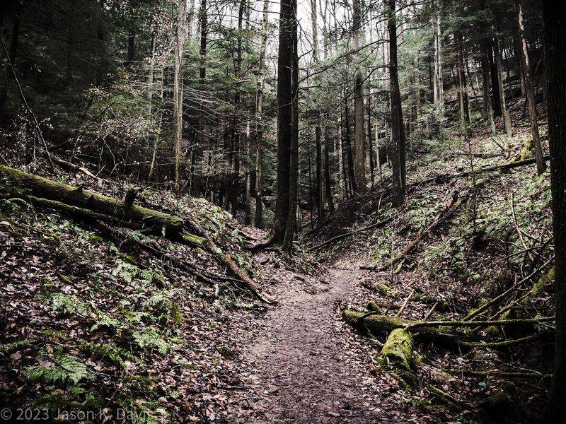
Navigation turns out to be a small adventure of its own at this spot. More than a few hikers mention that the markers and the map do not always line up, leaving them wondering if they wandered off course.
The confusion is common enough that people often recommend using a trail app to stay on track. Some parts of the one-way loop are not clearly marked, and side paths can look just like the real trail.
Getting turned around here is easy, and plenty of folks admit they accidentally stepped off the route at some point. The good news is that most make it through the whole way regardless.
A little preparation helps ease the guesswork. Downloading a map ahead of time and paying attention to the terrain keeps you moving in the right direction.
Part of the charm is the wild, less-manicured feel that comes with a remote trail. Just go in expecting to pay attention, and the puzzle becomes part of the fun.
Who This Rugged Hike Suits Best
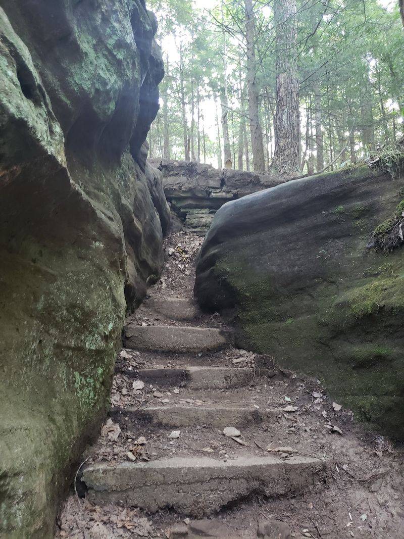
Honesty helps here, because this is not the gentlest walk in the park. The loop is rated on the lower end of moderate by some, while others find it genuinely challenging, especially with its steep climbs and unfenced drop-offs.
Those with knee, ankle, or hip trouble may want to think twice, since the strenuous terrain can be tough on the joints. The tricky stairs and narrow passages demand steady footing.
Families do tackle it, and some bring young children along, but caution is the theme. The large cliffs and open ledges mean small kids need a very close hand the entire way.
Teens and hikers in decent shape tend to enjoy it most, finding the ruggedness fun rather than frustrating. The extra effort is part of why so many call it a favorite.
Come with good shoes, a bit of stamina, and respect for the edges. Match the trail to your ability, and it delivers a rewarding day out.
Planning Your Visit To The Cliffs
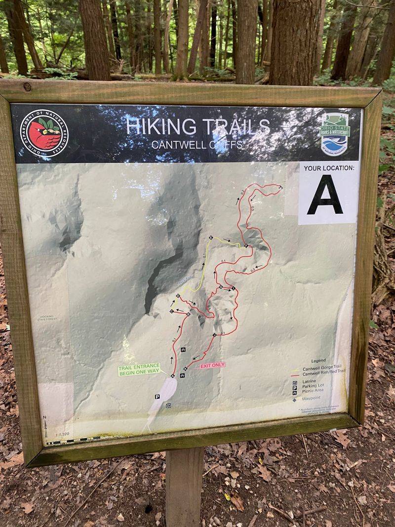
A smooth trip starts with a few simple details. The parking area holds around thirty cars, and because the spot sees fewer crowds, finding a space is usually manageable.
Navigation apps have no trouble locating the address at 13640 OH-374 in Rockbridge, and having a backup map handy never hurts. More trip information lives on the Ohio Department of Natural Resources website for the Hocking Hills area.
The loop itself is short in distance, often finished in anywhere from thirty-five minutes to about an hour and a half depending on your pace and route. Restrooms sit near the trails, though they are the basic no-flush variety, so set your expectations accordingly.
Pack light but smart, with sturdy footwear and extra water topping the list. The one-way trail design helps keep foot traffic flowing safely through the narrow sections.
Give yourself enough daylight to enjoy the climbs and the views without rushing. A little planning makes the rugged terrain far more enjoyable.
Enjoyed this story?
Add Fast Food Club as a preferred source to see more of our reporting on Google.