


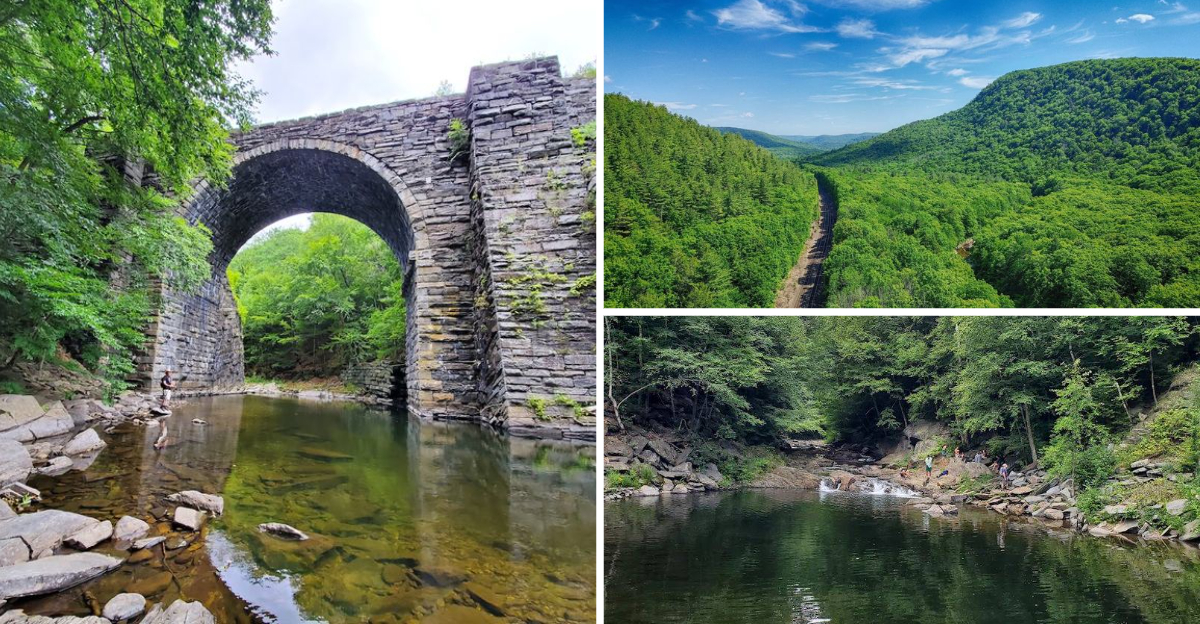
Tucked away in the quiet hills of Chester, Massachusetts, the Keystone Arch Bridges trail is one of those rare places that makes you feel like you have stepped into another century. Ancient stone bridges rise above a rushing river, surrounded by dense forest and the echoes of railroad history dating back to the 1800s.
With a near-perfect 4.8-star rating and glowing reviews from hikers of all ages, this trail has earned its reputation as a must-visit gem in western Massachusetts. Whether you are a history lover, a nature fan, or just looking for a beautiful walk, this trail delivers something truly unforgettable.
The Historic Keystone Arch Bridges Themselves
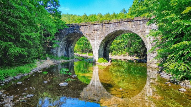
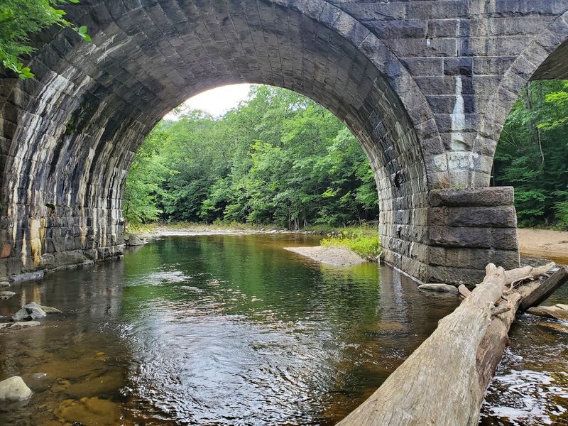
Back in the 1830s, engineers faced a seemingly impossible challenge: how do you build a railroad across the Berkshire Mountains? The answer was the keystone arch bridge, and three of these stone masterpieces still stand today along this trail in Chester, MA.
The most accessible is the double arch bridge near the parking area, which greets you early on the trail. Two more single-arch bridges wait further along the path, rewarding hikers who push deeper into the woods.
A steel girder bridge and a concrete arch bridge also appear along the way.
Each structure tells a story of human determination and 19th-century engineering genius. Informative kiosks placed throughout the trail share fascinating facts and figures about how these bridges were built.
Standing beneath one and looking up feels genuinely awe-inspiring, like reading a chapter from a history book written in stone.
A Railroad That Changed the World
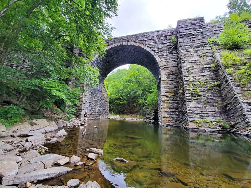
Long before highways and airports, the Western Railroad made history as the first railroad line to cross a mountain range anywhere in the world. That remarkable achievement happened right here in Chester, Massachusetts, and the stone arches left behind are living proof of that milestone.
Walking this trail means retracing the footsteps of 19th-century laborers who carved a path through rugged mountain terrain using tools that seem primitive by today’s standards. The railroad cutouts, where the tracks were blasted through solid rock, are still visible along the route and add a dramatic visual punch to the hike.
One lucky hiker even caught a freight train passing by during their visit, proving this corridor still carries a pulse. Connecting with that layered history while breathing fresh mountain air makes every step feel meaningful and surprisingly exciting for visitors of all ages.
The Westfield River Running Through It All
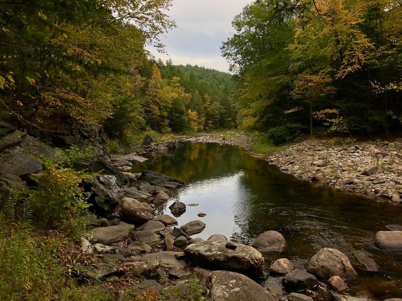
Even if the bridges did not exist, the Westfield River alone would be worth the trip. The trail follows the river for most of its length, treating hikers to a constant soundtrack of rushing water that feels like nature’s own background music.
The river is strikingly clear, tumbling over smooth stones and carving little pools that shimmer in the sunlight. During drier months the water levels drop, but the beauty remains.
When rainfall is generous, small brooks and mini-waterfalls cross the trail, adding extra charm to an already picturesque walk.
Trout swim in these cold waters, making it a popular fishing spot for locals. Families often stop along the banks for a picnic, letting kids splash at the water’s edge.
The river gives the entire hike a refreshing, almost fairy-tale quality that keeps pulling your eyes away from the trail ahead.
Cool Swimming Holes Along the Way
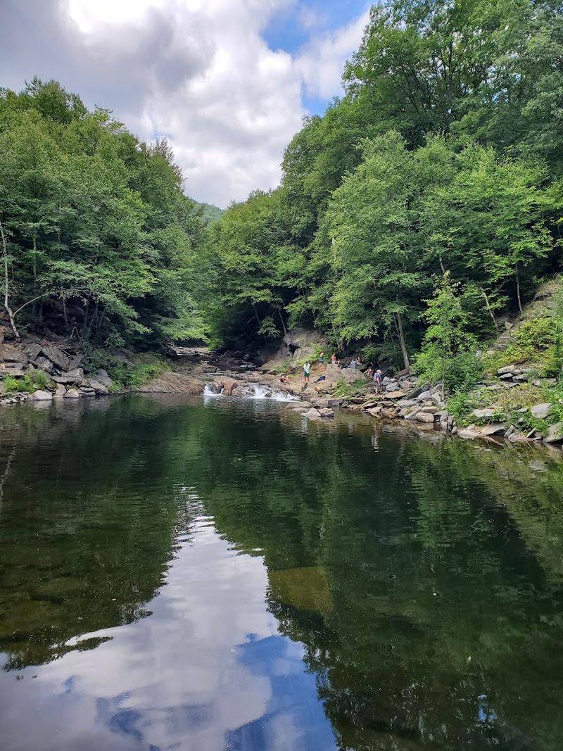
Summer hikers have a special bonus waiting for them along the Keystone Arch Bridges trail: natural swimming holes tucked along the riverbank. These calm, clear pools are formed where the Westfield River widens and slows, creating perfect spots to cool off after a warm stretch of walking.
Reviewers rave about stumbling upon these hidden gems, especially on hot days when the trail gets a little sweaty. The water stays refreshingly cold even in July, fed by mountain streams flowing down from the surrounding hills.
Kids absolutely love these spots, and adults tend to linger longer than planned.
Just remember to bring a towel and wear shoes you do not mind getting wet, since reaching some pools requires stepping across rocks. Pack a snack, find a flat boulder to sit on, and enjoy one of those simple, perfect moments that only nature can provide.
Trail Length and Difficulty Level
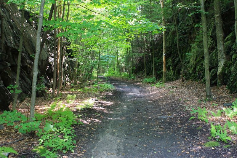
One of the things hikers love most about this trail is how approachable it feels. The main route runs about 2.5 miles each way, making it a roughly 5-mile out-and-back adventure that most reasonably fit people can handle without feeling overwhelmed.
Total elevation gain sits around 600 feet spread across the full distance, which means the incline is gradual rather than punishing. The path travels upriver on the way out, so you gain elevation slowly without noticing too much.
Some sections are wide enough for two people to walk side by side, which makes conversation easy and the pace comfortable.
A few stretches get muddy after rain, and the ground can be uneven with rocks and sand, so supportive footwear is a smart choice. People with limited mobility may find certain sections tricky, but many hikers complete a shorter portion and still enjoy a rewarding experience.
Informative Kiosks and Educational Signage
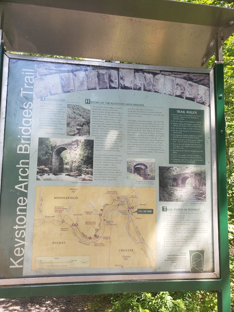
History comes alive on this trail not just through the bridges themselves, but through a series of well-placed educational kiosks scattered along the route. These signs explain the engineering behind the arches, the story of the Western Railroad, and the incredible human effort it took to build this infrastructure in the 1800s.
Parents hiking with kids find these stops especially useful, turning what could be a simple walk into an interactive outdoor classroom. Children who might otherwise rush past the bridges tend to slow down when they see charts, diagrams, and historical photographs displayed at eye level.
The information is written in an accessible way, making it easy for younger readers to grasp complex engineering concepts without getting bored. Several reviewers specifically mention the kiosks as a highlight, noting that they added real depth to the experience.
Bring a curious mind and you will leave knowing something genuinely new.
Off-Trail Viewpoints for the Best Bridge Sightlines
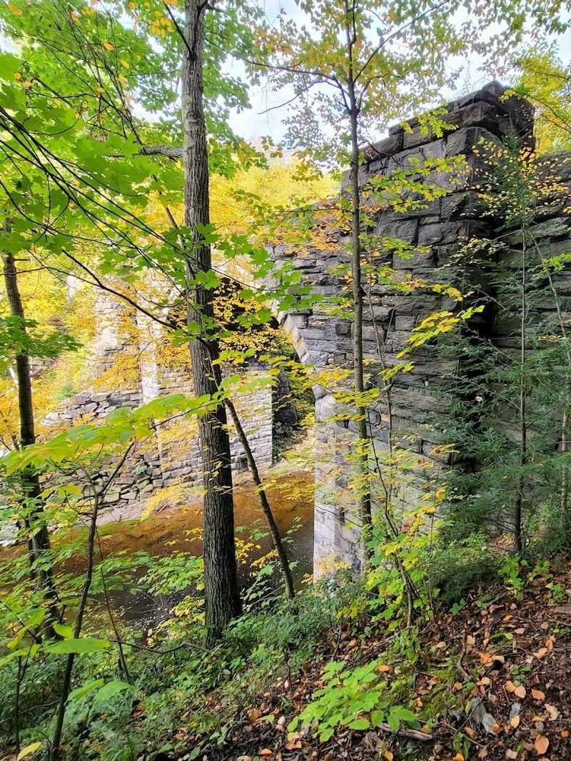
Here is a little insider tip that regular visitors swear by: the best views of the bridges do not always come from the main trail. Short offshoots branching away from the primary blue-blazed path lead to vantage points where the full scale of the arches becomes dramatically clear.
From certain angles, you can see the entire span of a bridge reflected in the river below, with forest framing the scene on both sides. These spots make for stunning photographs and quiet moments of reflection.
The bridge furthest along the trail even offers a sweeping view downriver, which hikers describe as an ideal lunch break location.
Just pay attention when exploring these side paths, especially during autumn when fallen leaves can hide the trail. Always return to the main blue-tagged route before continuing.
The extra effort to find these viewpoints pays off in ways that standard trail photos simply cannot capture.
Dog-Friendly Adventure for Four-Legged Friends

Good news for dog owners: the Keystone Arch Bridges trail welcomes four-legged hiking companions. Plenty of reviewers mention bringing their dogs along and having a fantastic time, and it is easy to see why pups love this place so much.
The river offers endless opportunities for dogs to splash, drink, and cool down between stretches of walking. The wide sections of trail give larger dogs room to trot comfortably without feeling cramped.
Smells from the dense forest and riverside ecosystem keep curious noses busy the entire way.
Just keep your dog on a leash, especially near the steep sections leading down to the bridge bases, where footing can be tricky for both animals and humans. Bring fresh water for your pup since trail water should not be assumed safe to drink.
A tired dog at the end of this hike is a very happy dog indeed.
Parking Tips and Trailhead Navigation
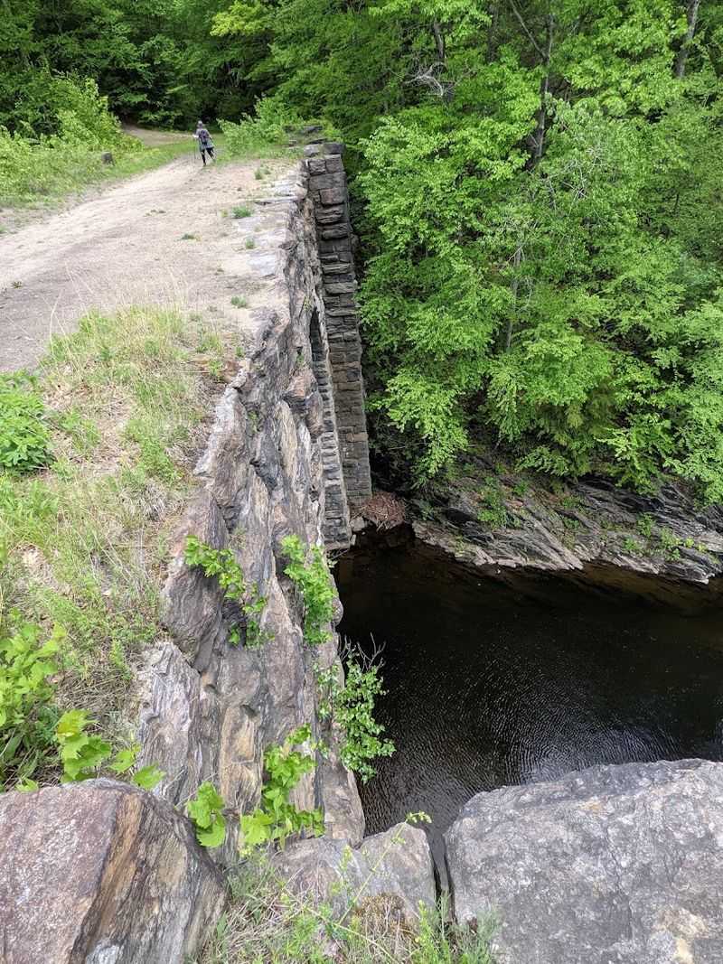
Getting to the trailhead requires a little planning, and a few hikers have learned this the hard way. Some GPS directions bring visitors to sections of the arches that lack any parking area, leaving drivers scrambling for a place to leave their car.
Always search specifically for the trailhead parking when using navigation apps.
Two small lots serve the trail: one near the double arch bridge that fits around five or six cars, and another upper lot holding six to eight vehicles. Both fill up quickly on weekends and during peak fall foliage season, so arriving early in the morning is strongly recommended.
The entrance road is unpaved and bumpy, giving the approach a charmingly rustic feel that fits the trail’s overall character. Cell service can be spotty in this rural area, so downloading offline maps beforehand is a smart move.
A little preparation ensures the adventure starts smoothly.
Fall Foliage and Seasonal Trail Beauty
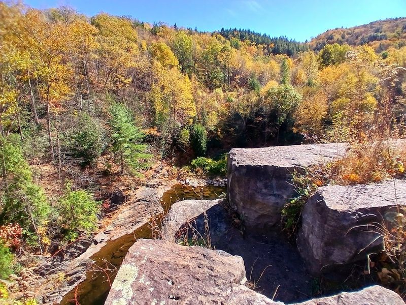
Autumn transforms the Keystone Arch Bridges trail into something that genuinely looks like it belongs on a postcard. The surrounding hillsides explode with orange, red, and gold as the season shifts, wrapping the stone bridges in a warm, fiery frame that photographers dream about.
One reviewer notes that fallen foliage can sometimes obscure the path, so paying close attention to the blue metal trail markers becomes especially important during October and November. The markers are numerous, but a few turns can catch hikers off guard when leaves pile up on the ground.
Spring brings its own magic, with wildflowers emerging along the riverbank and waterfalls running at full force after snowmelt. Summer offers the swimming holes and dense green canopy.
Even winter visits have their quiet appeal, with snow-dusted stone arches creating a moody, timeless scene. Every season offers a fresh reason to return.
Family-Friendly Fun for All Ages
Few trails in western Massachusetts tick as many family boxes as this one. The relatively gentle terrain, the fascinating history, the river, and the impressive stone bridges combine to create an outing that keeps both kids and adults genuinely engaged from start to finish.
Children respond especially well to the kiosks, the bridge architecture, and the river access points where they can poke around in the shallows. Parents appreciate that the trail is wide enough to keep an eye on wandering little ones without stress.
Even grandparents with a moderate fitness level have completed portions of the trail and come away smiling.
Pack a picnic, bring bug spray (especially in warmer months), and plan for at least two to three hours to enjoy the experience without rushing. Reviewers consistently recommend this spot for families, calling it a perfect blend of outdoor adventure and living history that kids genuinely remember long afterward.
Catching a Live Freight Train Passing By
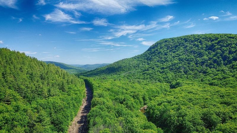
Stumbling upon active railroad tracks mid-hike might sound surprising, but it is one of the unexpected delights that some visitors encounter along this trail. The corridor near the bridges still sees freight train traffic, and catching one rumble past adds a thrilling, almost cinematic moment to the experience.
One reviewer described the timing as “fortuitous,” watching a full freight train pass with the stone arches as a backdrop. That combination of 19th-century stone engineering and modern rail operations in the same frame is genuinely hard to find anywhere else in New England.
Train sightings are not guaranteed, of course, so think of it as a bonus rather than a scheduled attraction. Still, keeping your eyes and ears open near the track areas makes the experience feel like a real-life adventure unfolding in real time.
It is the kind of unexpected moment that makes a good hike become a great story.
What to Bring for the Perfect Visit
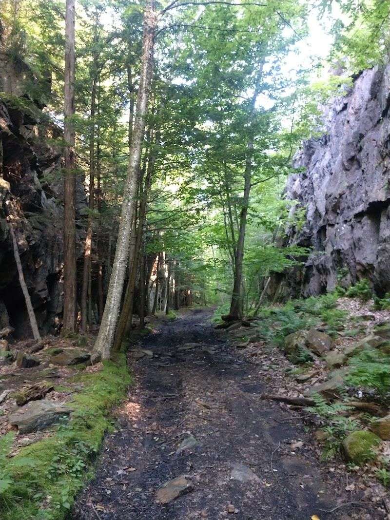
A little preparation goes a long way on the Keystone Arch Bridges trail. Sturdy, closed-toe shoes with good ankle support are a must, since the path includes uneven ground, rocks, and sandy patches that can catch flat-soled footwear off guard.
Waterproof boots are a smart upgrade if rain is in the forecast.
Bring more water than you think you need, especially in summer when the trail gets warm despite the tree cover. Snacks and a packed lunch make the riverside viewpoints feel like a proper outdoor dining experience.
Bug spray is essential from late spring through early fall, as reviewers specifically call it out as a necessity.
Download offline maps before you go since cell service is unreliable in this rural area. A fully charged phone for photos is worth it because the scenery demands documentation.
With the right gear and a relaxed pace, this trail rewards every visitor generously.
Enjoyed this story?
Add Fast Food Club as a preferred source to see more of our reporting on Google.